Murmansk
| city
Murmansk
Мурманск
|
||||||||||||||||||||||||||||||||||||||||||||
|
||||||||||||||||||||||||||||||||||||||||||||
|
||||||||||||||||||||||||||||||||||||||||||||
| List of cities in Russia | ||||||||||||||||||||||||||||||||||||||||||||
Murmansk ( Russian Му́рманск ; Kildinsamisch Мурман ланнҍ / Murman lann '; Finnish also Muurmanski, outdated Muurmanni ) is a northern European port city on the Russian peninsula Kola , north of the Arctic Circle . It has 307,257 inhabitants (as of October 14, 2010). The foothills of the Gulf Stream ensure the city has an ice-free port even in winter, which was a restricted military area until 1991. Murmansk and Severomorsk , 20 km to the north, are important bases of the Russian Northern Fleet .
Surname
The city was founded in October 1916 under the name Romanow am Murman (Russian Романов-на-Мурмане / Romanow-na-Murmane ). Romanov was the name of the Russian Tsar dynasty, Murman was the name given to the north coast of the Kola Peninsula in Russia. The word comes from Norwegian and originally means Northmen, Norwegians .
However, shortly after the February Revolution and the overthrow of the last Russian tsar, the city was renamed Murmansk in April 1917.
geography
General information
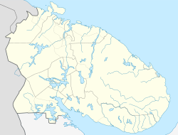
Murmansk is located on the eastern bank of a bay or a fjord of the Murmansk coast ( Russian Мурманский берег) on the Arctic Ocean , near the borders with Norway ( Kirkenes ) and Finland ( Ivalo ), about 1500 kilometers north of the capital Moscow as the crow flies . About ten kilometers north of the center is the former urban-type settlement of Roslyakovo , which was incorporated in 2015 and is an important location for the Northern Fleet .
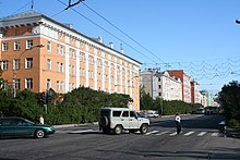
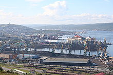
The city is the administrative seat of the Murmansk Oblast . With over 300,000 inhabitants, Murmansk is the largest city in the Arctic . Due to the city's location on the hillside along the Kola Bay and its large port facilities, the city is also known as the "Cape Town of the North". Due to the hillside location, there is a height difference of over 300 meters within the city.
City structure
| Stadtrajon (Gorodskoi Rajon ) |
Russian name | Resident January 1, 2006 |
comment |
|---|---|---|---|
| Leninsky | Ленинский | 93,473 | Name after Lenin |
| Oktyabrsky | Октябрьский | 98,938 | Name of Oktjabr ( October , referring to the October Revolution ) |
| Pervomaiski | Pervomaya | 128,551 | Name of Perwoje Maja ( May Day ) |
Climate information
| Murmansk | ||||||||||||||||||||||||||||||||||||||||||||||||
|---|---|---|---|---|---|---|---|---|---|---|---|---|---|---|---|---|---|---|---|---|---|---|---|---|---|---|---|---|---|---|---|---|---|---|---|---|---|---|---|---|---|---|---|---|---|---|---|---|
| Climate diagram | ||||||||||||||||||||||||||||||||||||||||||||||||
| ||||||||||||||||||||||||||||||||||||||||||||||||
|
Average monthly temperatures and rainfall for Murmansk
Source:
|
|||||||||||||||||||||||||||||||||||||||||||||||||||||||||||||||||||||||||||||||||||||||||||||||||||||||||||||||||||||||||||||||||||||||||||||||||||||||||||||||||||||
The winters are cold, but significantly warmer than in other Russian places north of the Arctic Circle due to the maritime influences of Norway . Also in Vladivostok , which is more than 25 degrees south , the mean temperature in January is 2.2 ° C colder. According to Köppen's climate classification, Murmansk 's climate is sub-arctic ( Dfc ), as the mean temperature only exceeds 10 ° C in the warmest two months.
history
The original inhabitants of the area are Sami . The city was only founded in the First World War in 1916 as the end point of the Murman Railway , built between 1915 and 1917 , in order to be able to supply the tsarist empire year-round with armaments from its western allies via its ice-free port . During the time of the Soviet Union , the Arctic settlements in Siberia were supplied from here in summer via the sea route ( Northeast Passage ) and the rivers, with ores being transported westwards and supplies eastwards. This system largely collapsed in the post-Soviet era due to the relatively high transport costs (especially icebreakers, ice reconnaissance) under market economy conditions, so that the use of the Northern Sea Route practically came to a standstill in the meantime and these remote outposts are only supplied by air.
After the outbreak of the October Revolution and the Russian Civil War , the city was occupied by British Entente troops in June 1918 and the Murmansk Tramway was built. It was not until March 13, 1920, that the Red Army succeeded in retaking the city.
In 1918 Murmansk became the capital of the newly established Murmansk Governorate . After its dissolution in 1927, the Okrug Murmansk was formed within the Leningrad Oblast and in 1938 the Murmansk Oblast, which still exists today .
During the German-Soviet War in World War II, Murmansk was the target of several attack operations by the Wehrmacht . Some of them were carried out together with Finnish troops . From the early summer of 1941, the Germans in the Silberfuchs company tried to conquer Murmansk and its port. This was intended to cut off the Soviet Union from the connection to the Barents Sea and thus from the northern convoys . However, the German forces were overall too weak so that they could not prevail against the bitter defense of the Far North by the Red Army . The rough terrain and the harsh weather conditions made things more difficult.
Murmansk suffered from massive German bomber attacks. Only Stalingrad was bombed more severely by the German air force.
In the city there was a prisoner of war camp 363 for German prisoners of war of the Second World War .
| year | Residents |
|---|---|
| 1939 | 117,069 |
| 1959 | 221,874 |
| 1970 | 308,642 |
| 1979 | 380,817 |
| 1989 | 468.039 |
| 2002 | 336.137 |
| 2010 | 307.257 |
Economy and Transport
Various research institutions for fisheries research and oceanography are based in Murmansk. Murmansk, together with the neighboring city of Severomorsk, is also the main base of the Russian northern fleet. The port of Murmansk remains ice-free even in winter due to the foothills of the Gulf Stream , but it has to be kept clear at times by icebreakers .
In addition to the Northern Fleet, two kilometers north of Murmansk, there is also the Russian icebreaker fleet with nuclear and conventionally powered ships. The fleet includes six nuclear icebreakers , a nuclear-powered transport ship and a river icebreaker. Rosatom has been the operator of the ships since 2008 , before that they belonged to the Murmansker Seereederei , a private company in which the state still has a very large share. The icebreakers serve both the supply of the eastern Arctic regions and other, primarily tourist purposes.
The Murmansk airport is 24 km south from the city center. In addition to Russian airlines such as Aeroflot , Nordavia , UTair , Orenair or Rossija , the airport is also served by foreign airlines, in particular Finnish Finnair .
There is a connection to Saint Petersburg via the Murman Railway (the journey takes around 28 hours) and Moscow . The European route 105 leads to Saint Petersburg (corresponds to the Russian R21 Kola ) and Kirkenes in Norway. In 2016 Murmansk received a special status that allows cruise passengers to stay for 72 hours without a visa.
The neighboring city of Severomorsk and parts of the port are still a restricted military area ; Murmansk itself can now also be visited by foreigners without any problems.
The raw materials company Arktikmorneftegazrazwedka is based in Murmansk.
Education and culture
After the end of the polar night, which lasts from November 29th to January 15th, Murmansk celebrates a great festival called "Greetings, sun!" ("Здравствуй, Солнце!"). It traditionally takes place on the last Sunday of January. The variety of events in the city center also includes music and dance performances by the indigenous people of the Kola Peninsula, the Sami, reindeer races, and ice sailing competitions on Lake Semyonov.
The Oblast Drama Theater was built by Yelisaveta Natanovna Chechik .
The Murmansk synagogue is the northernmost Jewish place of worship in the world.
Further educational institutions
- Faculty of the St. Petersburg State University of Transportation
- Branch of the North Eastern Academy of Civil Service
- Branch of the A. S. Gribojedow Institute for International Law and Economics
- Branch of the Metropolitan Humanities Institute
- Branch of the Moscow Humanities and Economic Institute
- Distance Education Department Murmansk of the St. Petersburg Academy of the Ministry of Interior Russia
- Murmansk Humanities Institute
- Institute of Economics and Law Murmansk
- Murmansk State Fishing Fleet Academy
- Murmansk State Technical University
- State University of the Arctic Murmansk
Museums
Town twinning
Murmansk lists the following twin cities :
| city | country | since |
|---|---|---|
| Rovaniemi |
|
1962 |
| Luleå |
|
1972 |
| Tromso |
|
1972 |
| Vadsø |
|
1973 |
| Jacksonville |
|
1975 |
| Groningen |
|
1989 |
| Szczecin |
|
1993 |
| Akureyri |
|
1994 |
| Alanya |
|
2014 |
| Minsk |
|
2014 |
| Harbin |
|
2015 |
sons and daughters of the town
- Sergei Kurjochin (1954–1996), pianist, multi-instrumentalist, band leader and composer of avant-garde jazz
- Wadim Wolkowizki (* 1956), Lieutenant General
- Igor Dunkul (* 1958), Russian-German composer and pianist
- Valery Kiriyenko (born 1965), biathlete
- Avraam Shmulevich (* 1965), Israeli Zionist and founder of the Bead Arzeynu movement
- German Andrejew (* 1966), soccer coach and former soccer player
- Vladimir Burmakin (* 1967), chess player
- Vladimir Konstantinov (* 1967), ice hockey player
- Denis Manturow (* 1969), politician
- Roman Oksjuta (* 1970), ice hockey player
- Larissa Kruglowa (* 1972), sprinter
- Sergei Roschkov (* 1972), biathlete
- Denis Jewsejew (* 1973), chess player
- Irina Malgina (* 1973), biathlete
- Yevgeny Nikitin (* 1973), opera singer
- Alexander Rustemow (* 1973), chess master
- Roman Lyashenko (1979–2003), ice hockey player
- Katerina Tretyakova (* 1980), soprano
- Nikita Alexejew (* 1981), ice hockey player
- Alexei Semyonov (* 1981), ice hockey player
- Sergei Balandin (* 1982), biathlete
- Uljana Denissowa (* 1983), biathlete
- Ilya Roslyakov (* 1983), ski jumper
- Slata Ohnewytsch (* 1986), Ukrainian pop singer
- Walentina Gunina (* 1989), chess player
- Yevgeny Timkin (born 1990), ice hockey player
Web links
- City Council website (Russian)
- Photos from Murmansk
Individual evidence
- ↑ a b Itogi Vserossijskoj perepisi naselenija 2010 goda. Tom 1. Čislennostʹ i razmeščenie naselenija (Results of the All-Russian Census 2010. Volume 1. Number and distribution of the population). Tables 5 , pp. 12-209; 11 , pp. 312–979 (download from the website of the Federal Service for State Statistics of the Russian Federation)
- ↑ The Norwegians 'own name, "nordmann" (plural: "nordmenn"), is pronounced [' nurman].
- ↑ Source: State Statistical Office of the Russian Federation
- ↑ wetterkontor.de
- ↑ Maschke, Erich (ed.): On the history of the German prisoners of war of the Second World War. Verlag Ernst and Werner Gieseking, Bielefeld 1962–1977.
- ↑ Source: Census data
- ↑ Bellona Foundation: Bellona ( Memento of November 24, 2005 in the Internet Archive )
- ↑ Data overview for Murmansk Airport ( Memento of the original from February 18, 2016 in the Internet Archive ) Info: The archive link was inserted automatically and has not yet been checked. Please check the original and archive link according to the instructions and then remove this notice. Murmansk Airport website, accessed February 18, 2016
- ↑ NZZ, September 28, 2016, page 2
- ↑ Announcement for "Hello, Sun!" 2009 ( Memento of the original from June 18, 2010 in the Internet Archive ) Info: The archive link was inserted automatically and has not yet been checked. Please check the original and archive link according to the instructions and then remove this notice. on an event website from Murmansk (Russian)
- ^ Synagogues at extreme latitudes. ( Memento of the original from March 31, 2013 in the Internet Archive ) Info: The archive link was inserted automatically and has not yet been checked. Please check the original and archive link according to the instructions and then remove this notice. In: Alnakka.net , accessed November 5, 2012


