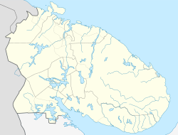
Roslyakovo (Murmansk)
| district
Roslyakovo
Росляково
|
||||||||||||||||||||||||||||||||
|
||||||||||||||||||||||||||||||||
|
||||||||||||||||||||||||||||||||
Rosljakowo ( Russian Росляково ) is a district of Murmansk , the administrative seat of Murmansk Oblast in Russia . As an independent village, Rosljakowo last had 8,696 inhabitants (as of October 14, 2010 census).
geography
The district is located on the Kola Peninsula, on the south bank of the Kola Bay about ten kilometers northeast of the center of Murmansk.
history
A settlement on the site of today's Roslyakovo was first mentioned in 1896.
In the 1930s, the neighboring bay of Grjasnaja Guba with the same name (since 1954 Safonowo ) was chosen as the location for the naval aviation forces of the Soviet Northern Fleet , with the prospect of expansion towards Roslyakowo and Chalmpushka (nearby village on the bay of the same name, today part from Roslyakovo). After the Second World War , the facilities of the Northern Fleet were massively expanded; In the Tschalmpuschka Bay near Rosljakowo / Tschalmpuschka, the repair shipyard No. 82 was built from 1946, where the PD-50 floating dock was in operation from 1980 . The places were administratively subordinate to the city soviet Severomorsk from 1951 , but were spun off as independent urban-type settlements in 1958 and merged in 1959 under the name Roslyakovo .
From 1996 Roslyakovo was subordinate to the administration of the seven kilometers to the east "closed" city (SATO, since 2004 urban district ) Severomorsk . With effect from January 1, 2015, the settlement was detached from the Severomorsk district and incorporated into Murmansk.
The nuclear submarine K-141 Kursk that crashed in 2000 was dismantled at the shipyard in Roslyakovo . In 2011 the outer hull of the submarine Yekaterinburg burned in the floating dock; contrary to initial information, its nuclear missiles had not been unloaded. The large floating dock PD50 sank at the end of October 2018 at its place of use, the ship repair workshop number 82, as a result of a power failure.
Population development
| year | Residents | Remarks |
|---|---|---|
| 1948 | 986 | Roslyakovo 401, Chalmpushka 585 |
| 1959 | 4.118 | |
| 1970 | 5,502 | |
| 1979 | 7,633 | |
| 1989 | 11,981 | |
| 2002 | 9,458 | |
| 2010 | 8,696 |
Note: census data from 1959
Economy and Infrastructure
In the settlement there is a shipyard of the Russian Northern Fleet, various construction and utility companies.
The northernmost section Murmansk - Severomorsk of the trunk road M18 coming from Saint Petersburg 1430 km away runs through Roslyakovo .
Opposite the settlement, in front of the village of Belokamenka , in the Kola Bay is the Belokamenka supertanker of the same name, currently (as of 2012) serving as a floating tank farm .
Individual evidence
- ↑ a b Itogi Vserossijskoj perepisi naselenija 2010 goda. Tom 1. Čislennostʹ i razmeščenie naselenija (Results of the All-Russian Census 2010. Volume 1. Number and distribution of the population). Tables 5 , pp. 12-209; 11 , pp. 312–979 (download from the website of the Federal Service for State Statistics of the Russian Federation)
- ↑ Historical overview on the website of the Severomorsk municipal administration (PDF, Russian; 195 kB)
- ↑ Sunk , Novaya Gazeta, October 30, 2018 (Russian)
- ^ Drydock Failure Damages Russia's Only Aircraft Carrier. In: maritime-executive.com. October 30, 2018, accessed October 30, 2018 .


