
Kirkenes
| Kirkenes | |||||
|---|---|---|---|---|---|
|
|||||
| Basic data | |||||
| Country | Norway | ||||
| Province (fylke) | Troms and Finnmark | ||||
| Municipality (commune) : | Sør-Varanger | ||||
| Coordinates : | 69 ° 44 ' N , 30 ° 3' E | ||||
| Residents : | 3,444 (2012) | ||||
| Area : | 2.03 km² | ||||
| Population density : | 1697 inhabitants per km² | ||||
| Height : | 25 moh. | ||||


Kirkenes [ ˈçirkəˌnɛːs ] ( Sami Girkonjárga ; Finnish Kirkkoniemi ) is a town in the municipality of Sør-Varanger in the east of the province of Troms og Finnmark in Northern Norway with about 3400 inhabitants.
General
The city is the administrative seat of the municipality of Sør-Varanger and lies on the Varangerfjord . It was granted city rights on January 1, 1999. Around 15% of the 3440 inhabitants come from abroad. The road signs in Kirkenes are trilingual: Norwegian , Finnish and Russian . The distance to the border with Russia is about 10 km, to that with Finland about 35 km.
Kirkenes is the seat of the Norwegian Barents Secretariat, which plays an important role in the work of the Barents Region, which was initiated by Norway in 1993 , an international association of regions of the countries bordering the Barents Sea , including the northern provinces of Norway, Sweden and Finland, the Russian regions of Murmansk and Arkhangelsk , the Komi and Karelia Republics and the Nenets Autonomous Okrug . As a hub for cooperation with north-western Russia, Kirkenes is also the seat of a Russian consulate general.
climate
The polar night lasts from November 27th to January 16th. The midnight sun shines from May 15th to July 28th. The average temperatures are −13 degrees Celsius in January and +14 degrees Celsius in July. The northern lights can be observed from September to March, depending on the weather conditions.
economy
_-_1957.jpg)
Kirkenes was created as a shipping port for iron ore . Up to 1996 most of the inhabitants lived from the mining of iron ore. Today the main occupation of the people of Kirkenes is fishing and the service sector .
The 1996 disused iron ore - open pit was resumed, the eight-kilometer private Erzbahn (Norwegian: Kirkenes Bjørnevatnbanen ) between open pit and the port has been revitalized of 2010. In December 2015, ore mining was shut down again.
traffic
lake

Since 1908, the city has been the northern turning point for Hurtigruten ships . Since the harbor lies far in the interior of the Varangerfjord and is not reached by the Gulf Stream , the frozen fjord has to be cleared of icebreakers in winter .
air
The Kirkenes Airport in Høybuktmoen use about 300,000 passengers per year (as of 2014).
country
The European route 6 and the European route 105 end and begin in Kirkenes.
Europe's longest cycle path, the Iron Curtain Trail , which runs along the former Iron Curtain to the Black Sea, also begins in Kirkenes. It was expanded with funds from the EU.
rail
The Kirkenes – Bjørnevatn railway, operated exclusively for freight, was the only railway in Kirkenes. As it only transported the production of the iron ore mine from Bjørnevatn , it was shut down in 2015 when the mine ceased operations.
The transport ministries of Finland and Norway commissioned a feasibility study for an Arctic Railway in 2017 . The result should be available in 2019. The project is examining several route variants.
history
Kirkenes and its surroundings are by far the oldest part of the European continent. The discovery of a 3.69 billion year old crystal near Kirkenes has exceeded the age of the continent estimated by researchers by 200 million years.
Around 1900 Kirkenes was a small place with a church ( Norwegian kirke ), which was built in 1862 on a headland ( nes ). Iron ore mining made the city grow from 1908.

Due to its strategic location, Kirkenes became a hotly contested city on the so-called Arctic Front during World War II . The city of Murmansk , about 150 kilometers away as the crow flies , was the only port in the European part of the Soviet Union that National Socialist Germany did not control or block. Therefore the ice-free port of Murmansk and the Murman Railway leading from Murmansk to Moscow became vital for the Allies. Supply transports ran from America and England through the Arctic Ocean to Murmansk in order to support the Soviet Union primarily with war material. The Germans, who had occupied Norway since 1940, moved around 30,000 soldiers to Kirkenes from June 1941. In addition, stronger German naval forces and an air force squadron were stationed in northern Norway with a base in Kirkenes. These had the task of obstructing or destroying the allied northern sea convoys . The attempts of the German " Mountain Corps Norway " to conquer the city of Murmansk and thereby shut down the Allied supply line ( company Silberfuchs ) were prevented by the Soviet defenders. Soviet planes bombed Kirkenes day and night. Over 1000 air raids and more than 328 air strikes by Soviet bombers made Kirkenes the most bombed city in Norway. After a terrible war of exhaustion on the Liza Front (after the Liza River on the Kola Peninsula ), often at 30 to 40 degrees below zero in winter and with thousands of fallen and frozen soldiers on both sides, the Red Army succeeded in repelling the German troops . In October 1944, the Red Army liberated the German-occupied cities of Petsamo and Kirkenes in the Petsamo-Kirkenes operation . Before they withdrew, the Germans had burned all but 20 houses that were left after the Soviet bombing.
Border with russia

At Kirkenes there is a border crossing to Russia and Murmansk. The land border between Norway and Russia ends in the north at the village of Grense Jakobselv ( Jacob River border ). During the Cold War , this was the only direct land border between NATO and the Soviet Union, along with the Turkey- Soviet Union, and thus the only one within Europe. As part of a special regulation made possible by the Schengen Agreement and so far unique in Europe, Russians and Norwegians who live in a 30-kilometer zone have been able to travel back and forth without a visa since April 2010.
People from Kirkenes
- Bendik Rugaas (* 1942), librarian and politician
- Per Oskar Kjølaas (* 1948), bishop and author
- Vegard Ulvang (* 1963), cross-country skier
- John Kristian Dahl (* 1981), cross-country skier
- Ørjan Nilsen (* 1982), DJ and music producer
Attractions

- The "Andersgrotta", a museum in an old air raid shelter
- The "Grenzlandmuseum"
- The "Savio Museum", with works by the artist Savio
- The Soviet Monument to the Liberation after World War II
- The church

photos

Pedestrian zone in Kirkenes (1975)

Pedestrian zone in Kirkenes (February 2005)

The port of Kirkenes (February 2005)

Russian trawler in the port of Kirkenes (September 2007)

Hurtigruten ship Midnatsol in the port of Kirkenes (March 2012)
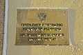
Sign on the house wall of the Russian Consulate General


Web links
- Kirkenes Municipality website (Norwegian)
- Tourist information : www.visitkirkenes.no (English)
Individual evidence
- ↑ a b Statistisk sentralbyrå: Tettsteder. Folkemengde og areal, etter commune. January 1, 2011 ( memento of March 24, 2012 in the Internet Archive ), accessed on September 29, 2011 (Norwegian).
- ↑ The place name means “church tip” or “church peninsula” in all three languages.
- ^ Website of The Norwegian Barents Secretariat.
- ↑ Kirkenes is considered the capital of the Barents region and is Norway's "gateway to the east". On: VisitNorway.com .
- ↑ Traffic statistics for 2014 at avinor.no , accessed on February 9, 2015.
- ↑ Iron Curtain Trail - The northern part. (No longer available online.) Archived from the original on July 6, 2017 ; Retrieved April 17, 2017 . Info: The archive link was inserted automatically and has not yet been checked. Please check the original and archive link according to the instructions and then remove this notice.
- ↑ Study on the Arctic rail line completed: Kirkenes routing to be examined further. (PDF) Jernbane Directorate, March 22, 2018, accessed on November 5, 2018 .
- ↑ Small border traffic at the northern tip of Europe. In: The press. Vienna, April 26, 2010.