Olenegorsk
| city
Olenegorsk
Оленегорск
|
||||||||||||||||||||||||||||||||||||||||||||
|
||||||||||||||||||||||||||||||||||||||||||||
|
||||||||||||||||||||||||||||||||||||||||||||
| List of cities in Russia | ||||||||||||||||||||||||||||||||||||||||||||
Olenegorsk ( Russian Оленегорск ) is a city in Murmansk Oblast ( Russia ) with 23,072 inhabitants (as of October 14, 2010).
geography
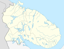
Olenegorsk is located on the Kola Peninsula beyond the Arctic Circle , about 110 km south of the oblast capital Murmansk . In the area of the city, the watershed runs between the Barents Sea (lakes Kachosero and Kolosero northwest of the city; the Kola drains off ) and the White Sea (Lake Permussosero east and the north end of Lake Imandra southeast of the city).
Olenegorsk is directly subordinate to the Oblast .
history
The place originated in 1916 as a settlement Olenja around the station built here on the Murmanbahn . The name is derived from the Russian word olen for deer , especially ren (Russian sewerny olen , literally northern deer ). With gora (= mountain) the German translation means Hirschberg . Which corresponds to the coat of arms and the flag.
In connection with the start of the production of iron ore from a deposit discovered in 1932, the construction of the actual city began in 1949. On March 27, 1957, town charter was granted under its current name.
- Population development
| year | Residents |
|---|---|
| 1959 | 12.110 |
| 1970 | 21,485 |
| 1979 | 27,369 |
| 1989 | 35,584 |
| 2002 | 25.166 |
| 2010 | 23,072 |
Note: census data
economy
In addition to the townscape-defining mining (in open-cast mining ) and the enrichment of iron ore, there are mechanical engineering and metalworking industries, building materials and the food industry in the city.
traffic
The town lies on the 1917 opened Murmansk , a day for October Railway of RZD belonging railway from Saint Petersburg to Murmansk (Station Olenja , kilometer 1335). A 30-kilometer branch line branches off here to Montschegorsk .
The M18 St. Petersburg – Severomorsk road also runs through Olenegorsk .
A few kilometers east of the city and the Permussosero is the Olenja military airfield with the associated settlement Vysoki . From there, on October 30, 1961, a Tupolev Tu-95 bomber was launched in the direction of Novaya Zemlya to drop the 50 megatons strongest hydrogen bomb ever detonated , the so-called Tsar bomb , over the test site there .
sons and daughters of the town
- Dmitri Treschtschow (* 1964), mathematician and mechanics expert
- Dmitri Vlassenkow (* 1978), ice hockey player
- Nikita Wyglasow (* 1985), ice hockey player
- Ekaterina Grigoryeva (* 1989), model
- Daniil Ejbog (* 1997), short tracker
- Lyudmila Samsonova (* 1998), tennis player
Web links
- City administration website (Russian)
- Olenegorsk on mojgorod.ru (Russian)
Individual evidence
- ↑ a b Itogi Vserossijskoj perepisi naselenija 2010 goda. Tom 1. Čislennostʹ i razmeščenie naselenija (Results of the All-Russian Census 2010. Volume 1. Number and distribution of the population). Tables 5 , pp. 12-209; 11 , pp. 312–979 (download from the website of the Federal Service for State Statistics of the Russian Federation)


