Kola (city)
| city
Kola
Кола
|
||||||||||||||||||||||||||||||||||||||||
|
||||||||||||||||||||||||||||||||||||||||
|
||||||||||||||||||||||||||||||||||||||||
| List of cities in Russia | ||||||||||||||||||||||||||||||||||||||||
Kola ( Russian Кола ) is a city in Murmansk Oblast ( Russia ) with 10,437 inhabitants (as of October 14, 2010).
geography
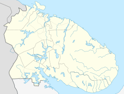
The city is located on the Kola Peninsula about twelve kilometers south of the Oblast capital Murmansk at the confluence of the Tuloma and Kola rivers in the Kola Bay of the Barents Sea .
Today Kola is a satellite town of Murmansk and the administrative center of the raion of the same name .
The town lies on the 1917 opened Murmansk , a day for October Railway of RZD belonging railway from Saint Petersburg to Murmansk (1438 kilometer). A branch line branches off here to Petschenga and Nikel (186 km). The trunk road R21 Saint Petersburg - Severomorsk bypasses Kola to the east and continues over the Kolabucht Bridge in the direction of Petschenga and the Norwegian Finnmark . Murmansk Airport is located near Kola .
history
The place was first mentioned in 1264 as a pomor settlement Kolo . In 1583–1584, tsar Ivan IV dispatched 400 strikers to build the Kola Ostrog , which was soon called the city of Kola .
In the 15th to 17th centuries, Kola was one of the starting points for trips to Spitsbergen ( called Grumant by the Pomors at that time ) and Novaya Zemlya .
The fortifications were renewed under Peter the Great in 1700–1706. In the 18th century the city lost its importance as a trading center in the north of Russia, but received regular city charter in 1781 (or 1784).
During the Crimean War , the fortress and town were almost completely burned down by English troops in 1854.
In 1926, a decade after Murmansk was founded, Kola lost its town charter, but received it again in 1965.
Population development
| year | Residents |
|---|---|
| 1897 | 615 |
| 1926 | 614 |
| 1939 | 8,385 |
| 1959 | 12,273 |
| 1970 | 12,085 |
| 1979 | 13,301 |
| 1989 | 16,541 |
| 2002 | 11,060 |
| 2010 | 10,437 |
Note: census data
Culture and sights
In Kola, the earth wall and the moat of the old fortifications have been preserved, as well as one of the oldest stone buildings on the peninsula, the Cathedral of the Annunciation ( Благовещенский собор / Blagoweschenski sobor) from 1800 to 1809.
There is a pomor museum in the city.
economy
There is a furniture factory and food industry in Kola. Above the nearby settlement of Murmaschi , Kolenergo AG (part of the Unified Energy System ) operates a hydropower plant on the Tuloma .
Town twinning
- Inari , Finland
Web links
- Kola on the Rajon Administration website (Russian, partly English)
- Kola on mojgorod.ru (Russian)
Individual evidence
- ↑ a b Itogi Vserossijskoj perepisi naselenija 2010 goda. Tom 1. Čislennostʹ i razmeščenie naselenija (Results of the All-Russian Census 2010. Volume 1. Number and distribution of the population). Tables 5 , pp. 12-209; 11 , pp. 312–979 (download from the website of the Federal Service for State Statistics of the Russian Federation)


