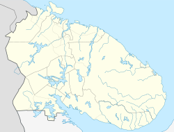
Umba (Russia)
| Urban-type settlement
Umba
Умба
|
||||||||||||||||||||||||||||||||||||||
|
||||||||||||||||||||||||||||||||||||||
|
||||||||||||||||||||||||||||||||||||||
Umba ( Russian У́мба ) is an urban-type settlement in the Murmansk Oblast in Russia with 5532 inhabitants (as of October 14, 2010).
geography
The place is about 250 km as the crow flies south of the Murmansk Oblast Administrative Center on the south coast of the Kola Peninsula , a little north of the Arctic Circle . It is located east of the mouth of the Umba River, which gives it its name, into the Kandalaksha Bay of the White Sea .
Umba is the administrative center of the Rajons Tersky and seat of the municipality (gorodskoje posselenije) Umba. In addition to the settlement, this includes the village of Olenitsa (50 km south-east on the coast) and the inland villages (nasseljonny Punkt) Indel (50 km north-east) and Wostochnoje Munosero (40 km north-north-east), which were not permanent residents in the 2010 census had more.
history
The Pomor village Umba on the right bank of the river was first mentioned in a document in 1466 as one of the oldest settlements on the Kola Peninsula. As a result, it was subordinate to the Solovetsky Monastery .
In 1769, Jean-Louis Pictet observed the transit of Venus here .
In 1898 the industrialist Belyayev had a sawmill built nearby; the associated settlement was named Lesnoi (from Russian les for "forest" or "wood"). In 1927 the settlement became the administrative seat of a newly created Rajon, and in 1930 it received the status of an urban-type settlement.
In the 1960s, the settlement and village were united under the old name Umba . Unofficially, the village is referred to as Staraya Umba ("Old Umba"), the settlement about two kilometers to the east as Nowaja Umba ("New Umba").
Population development
| year | Residents |
|---|---|
| 1939 | 5196 |
| 1959 | 8950 |
| 1970 | 7268 |
| 1979 | 7699 |
| 1989 | 8309 |
| 2002 | 6497 |
| 2010 | 5532 |
Note: census data
traffic
The regional road 47K-010 leads to Umba, which branches off about 100 km northwest of Kandalaksha from the federal trunk road R21 Kola St. Petersburg - Murmansk. Further east, mainly along the coast, the road runs as 47K-011 for about 100 km to the village of Warsuga , the second largest town in the Rajons.
Kandalaksha is also the closest train station to the Murman Railway Saint Petersburg - Murmansk.
To the east of the settlement is a small airport ( ICAO code UMLA ).
Web links
Individual evidence
- ↑ a b Itogi Vserossijskoj perepisi naselenija 2010 goda. Tom 1. Čislennostʹ i razmeščenie naselenija (Results of the All-Russian Census 2010. Volume 1. Number and distribution of the population). Tables 5 , pp. 12-209; 11 , pp. 312–979 (download from the website of the Federal Service for State Statistics of the Russian Federation)


