Zelenoborsky
| Urban-type settlement
Zelenoborsky
Zеленоборский
|
||||||||||||||||||||||||||||||||||||||
|
||||||||||||||||||||||||||||||||||||||
|
||||||||||||||||||||||||||||||||||||||
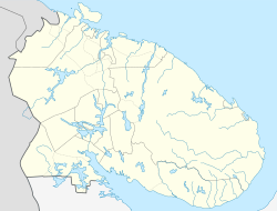
Zelenoborski ( Russian Зеленобо́рский ) is an urban-type settlement in Murmansk Oblast in Russia with 6,560 inhabitants (as of October 14, 2010).
geography
The place is located about 240 km as the crow flies south of the Murmansk Oblast Administrative Center on the right bank of the artificial outflow of Lake Kovdosero into Knjaschaya Bay, on the southwestern shore of the large Kandalaksha Bay of the White Sea . Somewhat separate about three kilometers southwest on the bank of the Kowdosero is the district Lessobirscha.
Selenoborski belongs to the Kandalakschski Rajon and is located about 35 km south of its administrative seat Kandalakscha . It is the seat of the municipality (gorodskoje posselenije) Selenoborski, to which, in addition to the settlement, the villages Knjaschaja Guba (a little north) and Kowda (28 km southeast), the localities (nasseljonny point) Lessosawodski and Pojakonda (respectively 25 and 35 km southeast) as well the settlements at the train stations Kowda (20 km southeast) and Schemchuschnaja (11 km northwest) belong.
history
The settlement was created in connection with the construction of the Knjaschegubskaya hydropower plant from 1951 and received the status of an urban-type settlement as early as 1952. For the hydroelectric power plant, an approximately four-kilometer-long artificial drain from Lake Kowdosero to the White Sea was created. At this drain there is a dam with the hydroelectric power station. At the same time, the natural outflow of the lake, the Kowda River , located about 10 km to the south-west, was blocked by another dam (the natural mouth of the river into the White Sea was almost 30 km southeast of today's Kowda part of the municipality of the same name) and the lake level was raised by about seven meters.
The power plant with a current output of 152 MW went into operation in stages between 1955 and 1959. As a result of the settlement of further companies, in particular a wood processing company west of the town in 1960, the population initially grew rapidly, but fell again by a third when they closed in the 1990s.
Population development
| year | Residents |
|---|---|
| 1959 | 9,000 |
| 1970 | 10,224 |
| 1979 | 10.122 |
| 1989 | 9,643 |
| 2002 | 7,640 |
| 2010 | 6,560 |
Note: census data
traffic
The federal trunk road R21 Kola from Saint Petersburg to Murmansk passes on the northern edge of Zelenoborsky .
West of the town center is the stop 1118 km of the Murman Railway Saint Petersburg - Murmansk, and about three kilometers south of the Lessobirscha district of the small Knjaschaja station .
Web links
Individual evidence
- ↑ a b Itogi Vserossijskoj perepisi naselenija 2010 goda. Tom 1. Čislennostʹ i razmeščenie naselenija (Results of the All-Russian Census 2010. Volume 1. Number and distribution of the population). Tables 5 , pp. 12-209; 11 , pp. 312–979 (download from the website of the Federal Service for State Statistics of the Russian Federation)


