
Heretic stone
| Heretic stone | ||
|---|---|---|
 View from the north |
||
| height | 610.1 m above sea level NHN | |
| location | Rhineland-Palatinate | |
| Mountains | Westerwald | |
| Coordinates | 50 ° 40 '48 " N , 8 ° 6' 29" E | |
|
||
| rock | basalt | |

The Ketzerstein is 610.1 m above sea level. NHN high mountain in the High Westerwald . Its north side slopes down to the village of Weißenberg and on to Liebenscheid in the Erlenbachtal. From the south side you can see the north tip of the Fuchskaute, 1½ km away, across a hollow .
The sources of the Ketzerbach are located in the above-mentioned basin, which flows through the Hickengrund with the inflow from Erlenbach / Weierbach under the name Winterbach and Wetterbach and finally flows into the Dill as Haigerbach . In the Ketzerbachtal, 1.4 km east-northeast of the mountain, there is the so-called triangle where the federal states of Hesse, North Rhine-Westphalia and Rhineland-Palatinate meet.
The European long-distance hiking trail 1 and the Westerwaldschleife of the Rothaarsteig lead over the summit .
The mountain is known for the rock formation consisting of cuboid basalts on its summit. This solitary basalt group is a natural monument and has been designated a geological sight in the Westerwald-Lahn-Taunus Geopark .
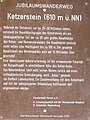
Information board on the Ketzerstein


Remarks
- ↑ TK 25 sheet 5314 'Rennerod'
- ↑ See GeoTope in Geopark WLT