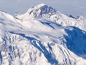
King Peak (Yukon)
| King Peak | ||
|---|---|---|
| height | 5173 m | |
| location | Yukon ( Canada ) | |
| Mountains | Elias chain | |
| Dominance | 4.7 km → Queen Peak | |
| Notch height | 1053 m ↓ King Col (4120 m) | |
| Coordinates | 60 ° 35 ′ 0 ″ N , 140 ° 39 ′ 17 ″ W | |
|
|
||
| First ascent | June 6, 1952 by Keith Hart and Elton Thayer | |
The King Peak is a 5,173 m high mountain in the Saint Elias Mountains in Canada's Yukon Territory . It is the fourth highest mountain in Canada.
King Peak is located in Kluane National Park . The 4120 m high and 3 km east located King Col forms the transition to the massif of the 13.75 km further east Mount Logan ( 5959 m ). 4.7 km to the northeast rises the 5380 m high Queen Peak , a western minor peak of Mount Logan, which forms the dominant reference to King Peak. The north and south-west flanks of King Peak are drained via the Quintino Sella Glacier to the Bering Glacier . In contrast, the ice flows below the southeast flank over the Seward Glacier and the Malaspina Glacier towards the sea.
Ascent history
King Peak was first climbed on June 6, 1952 by Keith Hart and Elton Thayer. They reached the summit via the north ridge and descended via the west ridge. The second and third ascent of King Peak took place in the same year - on July 23 by Pete Schoening and Gibson Reynolds and on July 24 by Pete Schoening, Dick McGowan and Bill Niendorff.
Web links
- King Peak on Peakbagger.com (English)
Individual evidence
- ^ Ichiro Yoshizawz: North America, Canada, Yukon Territory, King Peak, South Ridge . American Alpine Journal. 1970. Retrieved October 28, 2017.

