Kinglake (Victoria)
| Kinglake | |||||||
|---|---|---|---|---|---|---|---|
 in 2008 before being destroyed by a bushfire |
|||||||
|
|||||||
|
|||||||
|
|||||||
|
|||||||
|
|
|||||||
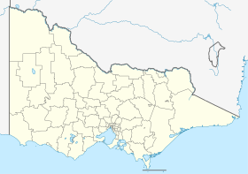
Kinglake is a city in the Australian state of Victoria and is located in the Murrindindi Shire . At the 2016 census , Kinglake had 1,159 residents. The city was largely destroyed by a bush fire in February 2009 .
geography
Kinglake is located 65 km northeast of Melbourne in the mountains belonging to the Great Dividing Range . The Kinglake Ranges reach a height of 525–610 m above sea level . Kinglake has a view of the Melbourne skyline to the southwest and the vineyards of the Yarra Valley to the south. The average temperature in Kinglake is around 3 ° C lower than in the metropolis of Melbourne. The summers are generally pleasant due to the forests, during the snowfall periods in winter there is sometimes heavy frost.
history
Kinglake Post's post office opened on May 14, 1883. There was also a post office in Kinglake East between 1914 and 1950.
Sports
The Aussie Rules football club, The Lakers, plays in the 2nd division of the Yarra Valley Mountain District Football League.
A basketball team plays in the Victorian Junior Basketball Leagues, and this club is also known as "The Lakers".
nature
The Kinglake National Park is the closest to Melbourne National Park, offers hiking trails for day trips and camping sites for overnight stays.
Another nature reserve is located between Toolangi and Yea. There are several waterfalls in it. They can be reached by moderately difficult hikes.
Bush fire
Bushfires in the area around Kinglake repeatedly affected the area and endangered the city and its population, for example in 1926, 1939, in the 1960s and during the Ash Wednesday fires in 1983. The fires in late January and early February 2006 burned 1,500 hectares Bushland before the fire brigade could contain the fires.
2009
Kinglake was one of the hardest hit areas by the 2009 Victoria bushfire ; in Kinglake and Kinglake West, the flames destroyed more than 500 homes and killed 42 people.
Web links
Individual evidence
- ↑ a b Australian Bureau of Statistics : Kinglake (L) ( English ) In: 2016 Census QuickStats . June 27, 2017. Retrieved April 19, 2020.
- ↑ Our darkest day ( English ) The Age . February 9, 2009. Retrieved February 12, 2009.
- ^ Premier Postal History: Post Office List . Retrieved February 11, 2009.
- ↑ Australia's Worst Bushfire Disaster ( English ) Australian Broadcasting Corporation . Retrieved February 11, 2009.
