Kirishima Kinkowan National Park
| Kirishima Kinkowan National Park | ||
|---|---|---|
| Summit of Sakurajima | ||
|
|
||
| Location: | Miyazaki , Kagoshima , Japan | |
| Surface: | 736.62 km² | |
| Founding: | March 16, 1934 | |
| Kapp Sata on the southern tip of Kinko Bay | ||
The Kirishima Kinkōwan National Park ( Japanese 霧 島 錦 江湾国 立 公園 , Kirishima Kinkōwan Kokuritsu Kōen ) is a Japanese national park on Kyūshū . Parts of the park are located in the two prefectures of Miyazaki and Kagoshima . The national park was founded in 1934 together with the Unzen Amakusa National Park on Kyūshū and the Setonaikai National Park around the Seto Inland Sea . This makes it one of the oldest national parks in Japan.
On March 16, 1964, the park around the island of Yakushima was added, which became the Kirishima Yaku National Park ( 霧 島 屋 久 国立 公園 , Kirishima Yaku Kokuritsu Kōen ). On March 16, 2012, however, Yakushima was spun off as an independent national park ( Yakushima National Park ) and the Kirishima Yaku National Park was renamed the Kirishima Kinkōwan National Park. The Japanese Ministry of Environment is responsible for the management of the national parks.
Park area
The park is divided into the following areas:
- Kirishima volcano group: u. a. Shinmoe-dake (1421 m), Karakuri-dake (1700 m), Hinamori-dake (1344 m) and Takachiho-no-mine (1573 m)
- Volcanic island Sakurajima (1117 m) and the Shigetomi beach in the Kinkō Bay (also Kagoshima Bay )
- Coast of Kinkō Bay from Chiringashima to Kapp Sata , including the stratovolcano Kaimon-dake (924 m) and areas around the lakes Ikeda and Unagi on the west side of the bay
- Takatoge Pass with a view of Sakurajima and Kinko Bay
Flora and fauna
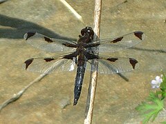
The national park provides a habitat for a variety of animal and plant species, including many rare bird and insect species, such as the critically endangered dragonfly Libellula angelina .
Summer magnolia ( Magnolia sieboldii ssp. Japonica )
Web links
- Kirishima Kinkōwan National Park on www.env.go.jp (English)
- Map of the Kirishima Kinkōwan National Park (PDF 1,728 KB, scale 1: 108,000 and 1: 155,000, English)
- World Database on Protected Areas - Kirishima-Kinkōwan National Park (English)
Individual evidence
- ↑ 屋 久 島 立 公園 . In: The Yakushima World Heritage Conservation Center. Retrieved November 2, 2014 (Japanese).


