Kissufim
| Kissufim | ||
|---|---|---|
| Basic data | ||
| hebrew : | כִּסּוּפִים | |
| State : |
|
|
| District : | south | |
| Founded : | 1950 | |
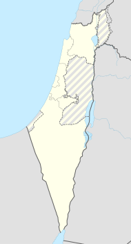
| Coordinates : | 31 ° 22 ' N , 34 ° 24' E | |
| Height : | 85 m | |
| Residents : | 238 (as of 2018) | |
| Community code : | 0840 | |
| Time zone : | UTC + 2 | |
| Website : | ||
|
|
||
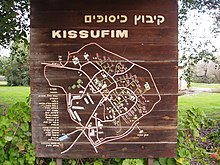
Kissufim ( Hebrew כִּסּוּפִים, German: die Sehnsüchtigen) is an Israeli kibbutz founded in 1950 . The founders, members of Zionist groups from northern and southern America, described their attitude by the place name: "those who long for (the land of Israel)."
Kissufim is located in the Eshkol regional administration , a few kilometers from the Israeli border with the Gaza Strip . In 2018 it counted a population of 238 people.
In economic terms, the kibbutz relies on milk production, chicken farming, lemon and avocado gardens and the leasing of land to the Israeli army . The kibbutz used to have a factory that produced plastic frames for glasses.
The Kissufim crossing was named after this kibbutz and was the main border crossing between Israel and the Gaza Strip for the Israeli settlers of Gush Katif . It was closed to inbound Israeli traffic on August 15, 2005 as part of the decoupling plan . The last Israeli soldiers left the Gaza Strip through this crossing and closed the gate on the morning of September 12, 2005. This marked the end of the complete withdrawal of the Israelis from the Gaza Strip; that also meant the end of 38 years of occupation.
Web links
- Official Website (Hebrew)
- A short film about Kissufim in the early 1950 Jewish Film Archive
Individual evidence
- ↑ אוכלוסייה ביישובים 2018 (population of the settlements 2018). (XLSX; 0.13 MB) Israel Central Bureau of Statistics , August 25, 2019, accessed May 11, 2020 .
- ↑ אוכלוסייה ביישובים 2018 (population of the settlements 2018). (XLSX; 0.13 MB) Israel Central Bureau of Statistics , August 25, 2019, accessed May 11, 2020 .

