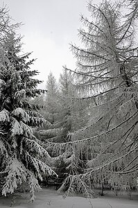
Little Hinggan Mountains
| Little Hinggan Mountains | ||
|---|---|---|
|
Larch taiga |
||
| Highest peak | Pingding Shan ( 1429 m ) | |
| location |
Heilongjiang (PR China), Jewish Autonomous Oblast , Amur Oblast , Khabarovsk Region ( Russia ) |
|
|
|
||
| Coordinates | 48 ° 48 ' N , 127 ° 12' E | |
The Little Hinggan Mountains (also Little Chingan ; Chinese 小 兴安岭 , Pinyin Xiao Xing'an Ling , Russian Малый Хинган ) extend north- west, starting at the course of the Songhua Jiang , which separates it from the Changbai Mountains, parallel to the Amur ( Heilong Jiang ) the Chinese province of Heilongjiang to the administrative area of the city of Heihe .
Only its southern foothills occasionally reach heights of almost 1500 m , to the north it flattens significantly. In the east, it continues beyond the Amur in Russia along the borders between the Jewish Autonomous Oblast and the Amur Oblast or the Khabarovsk region. There it reaches heights of almost 1200 m and merges into the Bureja Mountains in the north .
Its vegetation is to be seen as a link between the mixed deciduous forest of the Changbai mountainous region and the taiga (larch and birch forest) of the north-western Great Hinggan Mountains . The forests of the Little Hinggan are traditional hunting grounds for the Birar- Oroqen , a Tungus ethnic minority of China.
Web links
- Article Small Hinggan Mountains in the Great Soviet Encyclopedia (BSE) , 3rd edition 1969–1978 (Russian)

