Kley (Bergisch Gladbach)
|
Kley
City of Bergisch Gladbach
Coordinates: 51 ° 0 ′ 20 ″ N , 7 ° 9 ′ 12 ″ E
|
||
|---|---|---|
|
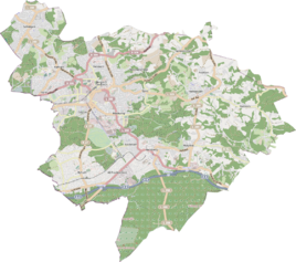
Location of Kley in Bergisch Gladbach |
||
|
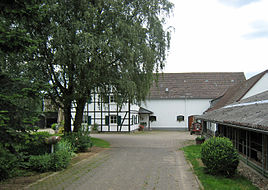
The Hof Kley 2015
|
||
Kley is a district in the Romaney district of Bergisch Gladbach .
history
The name Kley is an old farm and settlement name that is documented as early as 1400 in the form of Cleye . The original cadastre lists the settlement as Klei along the old road from Mülheim to Wipperfürth (today's Romaneyer Straße). In 1905 the hamlet consisted of three farms with 13 residents. The name of the settlement is derived from the Middle High German klebe (= sticky clay) and refers to the loamy soil quality of the area.
Mining
Mining took place in the Kley area over two thousand years ago. You can still see pings everywhere , representing the near-surface mining of iron . With the start of the coal and steel industry , the Prince Wilhelm mine was awarded here.
See also
Individual evidence
- ^ Andree Schulte, Bergisch Gladbach, city history in street names , published by the Bergisch Gladbach city archive, volume 3, and by the Bergisches Geschichtsverein department Rhein-Berg e. V., Volume 11, Bergisch Gladbach 1995, p. 103, ISBN 3-9804448-0-5
literature
- Anton Jux: The Bergisch Botenamt, the history of Bergisch Gladbach up to the Prussian era , published by the Culture Office of the City of Bergisch Gladbach, Bergisch Gladbach 1964


