The Schlade nature reserve
|
The Schlade nature reserve
|
||
|
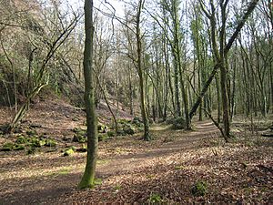
The Eastern Schladetal (2017) |
||
| location | Bergisch Gladbach , North Rhine-Westphalia , Germany | |
| surface | 27.59 ha | |
| Identifier | GL-002 | |
| WDPA ID | 81524 | |
| Geographical location | 51 ° 0 ' N , 7 ° 9' E | |
|
|
||
| Setup date | 1971 | |
| Framework plan | Landscape plan south district (Bergisch Gladbach, Overath, Rösrath) | |
| administration | Lower landscape authority Rheinisch-Bergischer Kreis | |
The nature reserve The Schlade extends as a dry valley from west to east in the district Schlade between the districts Hebborn and Romaney of Bergisch Gladbach on the edge of Paffrather Kalkmulde . To the north it is bounded by the districts of Grube and Kley and to the south by the district of Rommerscheid .
vegetation
The Schlade was designated as a nature reserve by the Cologne district government on August 3, 1971 and later again on July 22, 2008 . The protection designation was made for the preservation and development of the landscape- defining dry valley with a diverse biotope complex of limestone beech forests , steep slopes and former quarries .
In the area you will find species and herb rich beech forests that extend along the slopes to the Strunde and in the area of block rubble - spoil heaps and rock walls of the quarries. There are also locations of heat-loving orchids - beech forests , while in Schattlagen there are more canyon forests with ash trees . The rocks and mining terraces of the quarry north of the road are populated by bushes and birches - pioneer forest . Ivy , ferns and mosses grow in many places on the rocks and crevices . There are also various endangered plant species such as the spotted orchid or the deer tongue . Because of its biodiversity and the well-developed biotope complex with rocks, karstification, ravine forest and various forest communities, the area has an outstanding function as a refuge for numerous endangered animal and plant species and is therefore of national importance.
Mining
In the western part of the nature reserve is the now broken tunnel mouth hole of the Moll tunnel with upstream spoil heap of the Prince Wilhelm mine , where iron ore was mined until 1925 , which was most recently used for the chemical industry, especially because of the ocher content . Pinging from the Albert pit can be found in the southeastern part of the Schlade.
See also
Individual evidence
- ^ "Südkreis" landscape plan (Bergisch Gladbach, Overath, Rösrath), text part. (PDF) The District Administrator of the Rheinisch-Bergisches Kreis, 2008, p. 62 ff. , Accessed on March 2, 2017 .
Web pages
- Nature reserve "Die Schlade" (GL-002) in the specialist information system of the State Office for Nature, Environment and Consumer Protection in North Rhine-Westphalia


