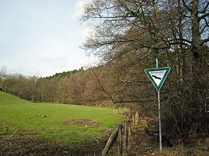
Krebsbachtal nature reserve
|
Krebsbachtal nature reserve
|
||
|
The lower Krebsbachtal near the mouth area (2017) |
||
| location | Bergisch Gladbach and Overath , North Rhine-Westphalia , Germany | |
| surface | 41,522 ha | |
| Identifier | GL-068 | |
| WDPA ID | 555514040 | |
| Geographical location | 50 ° 58 ' N , 7 ° 13' E | |
|
|
||
| Setup date | 2008 | |
| Framework plan | Landscape plan south district (Bergisch Gladbach, Overath, Rösrath) | |
| administration | Lower landscape authority Rheinisch-Bergischer Kreis | |

The nature reserve Krebsbachtal is located in the districts of Moitzfeld von Bergisch Gladbach and Immekeppel von Overath . It begins in the headwaters of the Krebsbach between Herweg and Steinacker and continues past Groß Hohn , Löhe , Bökenbusch and Schmitzbüchel into the Sülztal .
vegetation
The Krebsbach runs largely undisturbed and is mostly accompanied by alder trees . The valley slopes are mainly planted with mixed forests of hornbeam , oak and beech . The hillside meadows are mostly used and have several spring outlets . There are also some orchards in the reserve . The tributaries flowing to the side are close to nature and arise in small, well-developed spring swamps.
The protection designation was made for the preservation and development of a long, relatively undisturbed stream valley with alluvial forests as well as wet and humid grassland areas, orchards and poor meadows on the slopes.
Mining
Ore mining has been carried out on the Weiß pit since the middle of the 19th century . There was a large deposit in Steinacker, the field boundary of which reached up to the Krebsbach. From there, several tunnels were driven, the buried mouth holes and smaller heaps of which can still be seen today. In addition, the large stockpile of so-called ranging Laveissière-shaft down into the valley, which at the height of Steinacker sunk had been.
See also
Individual evidence
- ^ "Südkreis" landscape plan (Bergisch Gladbach, Overath, Rösrath), text part. (PDF) The District Administrator of the Rheinisch-Bergisches Kreis, 2008, pp. 82–83, 95 , accessed on February 25, 2017 .
- ^ Gerhard Geurts , Herbert Ommer , Herbert Stahl : Das Erbe des Erzes. Volume 1: The White Pit. Friends of the Bergisches Museum for Mining, Crafts and Trades, Bergisch Gladbach 2003, ISBN 3-00-011243-X .
Web pages
- "Krebsbachtal" nature reserve (GL-068) in the specialist information system of the State Office for Nature, Environment and Consumer Protection in North Rhine-Westphalia


