Hombachtal nature reserve
|
Hombachtal nature reserve
|
||
|
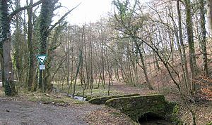
At the entrance to the Hombachtal (2017) |
||
| location | Bergisch Gladbach , North Rhine-Westphalia , Germany | |
| surface | 22,357 hectares | |
| Identifier | GL-064 | |
| WDPA ID | 555514036 | |
| Geographical location | 51 ° 0 ' N , 7 ° 11' E | |
|
|
||
| Setup date | 2008 | |
| Framework plan | Landscape plan south district (Bergisch Gladbach, Overath, Rösrath) | |
| administration | Lower landscape authority Rheinisch-Bergischer Kreis | |
The Hombachtal nature reserve extends between the Herrenstrunden and Herkenrath districts of Bergisch Gladbach . It encompasses the Hombach valley from the spring depths of a backwater at Breite with the Hombacher Berg via Oberhombach , Hombach to Unterhombach . The road leading through the Hombachtal ends in the Strundetal .
vegetation
The protection designation takes place for the maintenance and development of the brook valley, which is characterized by semi-natural alluvial forests , extensive grassland and well-developed beech forests on limestone and loess soils . The upper course is lined with alders and intensive grassland. A near-natural alder, ash and alluvial forest has been preserved near Unterhombach . Unterhombach north of the western side of the valley of extensive grassland is taken that of a wood-lined hollow road is divided. On the eastern side of the valley is the limestone dome of the Hombacher Berg, which is planted with well-developed, herb-rich pearl grass beech forest.
See also
Individual evidence
- ^ "Südkreis" landscape plan (Bergisch Gladbach, Overath, Rösrath), text part. (PDF) The District Administrator of the Rheinisch-Bergisches Kreis, 2008, pp. 65–66 , accessed on February 25, 2017 .
Web links
- Nature reserve “Hombachtal” (GL-064) in the specialist information system of the State Office for Nature, Environment and Consumer Protection in North Rhine-Westphalia


