Ko Mak
| Ko Mak เกาะ หมาก |
||
|---|---|---|
| Beach on Ko Mak | ||
| Waters | Gulf of Thailand | |
| Geographical location | 11 ° 49 '9 " N , 102 ° 28' 48" E | |
|
|
||
| length | 7.5 km | |
| width | 6 km | |
| surface | 16 km² | |
| Ko Mak in the north | ||
Ko Mak (also: Ko Maak , Thai เกาะ หมาก ) is an island in Thailand .
geography
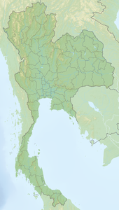
Ko Mak belongs to the Trat Province and is located in the eastern Gulf of Thailand between Ko Chang (north) and Ko Kut (south) and has a circumference of 27 kilometers with some sandy beaches. The island has a diameter of six kilometers and the shape of a four-leaf clover, the area is about 16 km². In contrast to the above, Ko Mak is largely flat. In addition to the beautiful beaches, the many smaller islands and islets are attractive. To the north of Ko Mak is the island of Ko Wai, which is surrounded by coral reefs , has quiet beaches and lush tropical flora. Ko Kradat to the east also has very beautiful beaches.
When the tide is particularly low , it is possible to hike to Ko Kham (about one kilometer northwest of Ko Mak). Ko Phi island , northwest of Ko Mak and southwest of Ko Kham, is uninhabited.
Ko Mak is not in the nature reserve and is therefore also used for agriculture. Mainly rubber trees and coconut trees are cultivated.
To the west of Ko Mak lies the Ko Rang archipelago, which has a mountainous character. On the islands nests of the bird species salangan are harvested, from which the Chinese swallow's nest soup is then made.
tourism
Tourism is not yet very developed. There are twelve resorts or bungalows . Scuba diving is possible around the island . There is a ferry to south of Trat located Laem Ngop , where the crossing takes three hours regularly. There are also speedboat connections several times a day, which are offered by some resorts and take about an hour.


