Stepped
|
ตราด stepped |
||
|---|---|---|
|
|
||
| Coordinates | 12 ° 15 ′ N , 102 ° 31 ′ E | |
| Basic data | ||
| Country | Thailand | |
| Stepped | ||
| ISO 3166-2 | TH-23 | |
| Residents | 10,207 (2012) | |
|
Trat main street
|
||
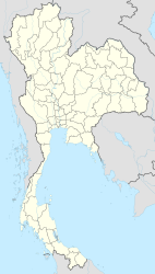
Trat ( Thai : ตราด , formerly also Ban Bang Phra ) is a city ( เทศบาล เมือง ตราด ) in the Thai province of Trat . It is the capital of the district ( amphoe ) Mueang Trat and the province of Trat.
It is believed that the name Trat comes from Krat . Trat was surrounded by krat, a tree used to make brooms , during the Ayutthaya period.
geography
The Trat Province is located in the eastern part of the central region of Thailand , in the extreme southeast of Thailand near the border with Cambodia . The city is just over 300 km from the capital, Bangkok .
Economy and importance
Trat is - thanks to its proximity to the Cambodian border - of some importance as a trading town. The area around Trat is rich in gemstone mines , the yield of which ( rubies and sapphires ) is processed on site. Even the fruit growing is significant: durian , rambutan and mangosteen fruits are the main products.
Trat is more interesting for tourists as a starting point to the large islands of Ko Chang and Ko Mak .
The city of Trat has 10,207 inhabitants. (Last updated 2012)
traffic
The city has an airport ( IATA airport code : TDX, ICAO code : VTBO).
history
Trat was already an important seaport in the Kingdom of Ayutthaya .
Under King Chulalongkorn (Rama V), Trat and the province of Chanthaburi were briefly occupied by the French . In a complicated exchange of territory, Trat (and Chanthaburi) was returned on March 23, 1906, but Thailand renounced the area around Siem Reap and Sisophon in what is now Cambodia.
Attractions
- Wat Chai Mongkol - a Buddhist temple ( Wat ) located in the city center with beautifully overgrown chedis .
Web links
- Trat City Council website (in Thai)
- City map of Trat (names in Thai and English) [last accessed on November 17, 2013]
Individual evidence
- ↑ Department of Provincial Administration : As of 2012 (in Thai)

