Kolberger Heide
| Kolberger Heide | ||
|---|---|---|
| Waters | Baltic Sea | |
| Geographical location | 54 ° 26 '32 " N , 10 ° 18' 57" E | |
|
|
||
| surface | 12 km² | |
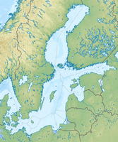
The Kolberger Heide is in places only 5 meters below sea level lying sand bank in the Baltic Sea north of the village Heidkate at the entrance of the Kiel Fjord .
geography
location
The Kolberger Heide is located in the Kiel Bay , east of Laboe . It is located about 0.3 nm north of the village of Heidkate and 2.6 nm south-east of the Kiel lighthouse . It is located directly south of the Kiel-Ostsee-Weg and the Kiel-Fehmarnsund-Weg . It is covered by various protected areas .
expansion
Its greatest width is around 1.5 nm and its greatest length around 4.5 nm. The area covers about 12 km².
Sea depth
While the Baltic Sea has an average depth of 52 m, the Kolberger Heide is on average 12 m deep, its shallowest point is 4.7 m.
history
Due to the storm surge of February 10, 1625, the area of the heather went under, the sand was deposited and settled in front of Laboe . The name was retained for the sea area. On July 1, 1644, during the Torstensson War, there was a sea battle on the Kolberger Heide , which ended in a victory for the Danes. The Danish royal anthem Kong Christian stod ved højen mast originated here.
The Kolberger Heide was fished by local fishermen until around 1942, after which time fishing was banned due to the increased threat from mines and bombs of the Allies .
On July 29, 1945 the area was designated as an ammunition dumping area by the British Military Government and over time around 50,000 tons of ammunition of all types were dumped.
Today the area belongs to the FFH area (Fauna-Flora-Habitat Directive) "Coastal landscape Bottsand - Marzkamp and upstream flat grounds" (DE1528-391) within the scope of Natura 2000 and is part of the EU bird sanctuary "Eastern Kieler" because of the large number of wintering seabirds Bay "(DE 1530-491).
Individual evidence
- ↑ Questions and facts about the Kolberger Heide. Nabu, February 6, 2015, accessed August 20, 2020 .
- ↑ a b The "Kolberger Heide" in the Kiel outer fjord. Nabu, accessed August 20, 2020 .
- ↑ a b M. Kampmeier, E. van der Lee, U. Wichert, J. Greinert: Exploration of the munition dumpsite Kolberger Heide in Kiel Bay, Germany: Example for a standardized hydroacoustic and optic monitoring approach. Elsevier Ltd, July 15, 2020, accessed August 20, 2020 .

