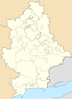
Komar (village)
| Komar | ||
| Комар | ||

|
|
|
| Basic data | ||
|---|---|---|
| Oblast : | Donetsk Oblast | |
| Rajon : | Velyka Novosilka district | |
| Height : | 144 m | |
| Area : | Information is missing | |
| Residents : | 1,705 (2004) | |
| Postcodes : | 85520 | |
| Area code : | +380 6243 | |
| Geographic location : | 47 ° 59 ' N , 36 ° 46' E | |
| KOATUU : | 1421282401 | |
| Administrative structure : | 9 villages | |
| Address: | вул. Єгорова 19 85 520 с. Комар |
|
| Statistical information | ||
|
|
||
Komar ( Ukrainian and Russian Комар ) is a village in the west of the Ukrainian Donetsk Oblast with about 1700 inhabitants (2004).
The village, founded in 1779 by Greek settlers of Crimea, is located in the north of the Velyka Novosilka district on the bank of the Mokri Jaly ( Мокрі Яли ), a 147 km long tributary of the Vovcha and on the N 15 highway 21 km northwest of the district center of Velyka Nowosilka .
Komar is the administrative center of the eponymous district municipality to which even the villages Wessele ( Веселе ) Dniproenerhija ( Дніпроенергія ), Zaporizhia ( Запоріжжя ) Nowootscheretuwate ( Новоочеретувате ) Skudne ( Скудне ) Fedoriwka ( Федорівка ) Sirka ( Зірка ) and Yalta ( Ялта ) belong.
Individual evidence
- ^ Official site of the village on the website of the Verkhovna Rada ; Retrieved September 19, 2016

