Kowalki (Rypin)
| Kowalki | ||
|---|---|---|

|
|
|
| Basic data | ||
| State : | Poland | |
| Voivodeship : | Kuyavian Pomeranian | |
| Powiat : | Rypin | |
| Geographic location : | 53 ° 3 ' N , 19 ° 24' E | |
| Residents : | ||
| Telephone code : | (+48) 54 | |
| License plate : | CRY | |
| Economy and Transport | ||
| Next international airport : | Warsaw | |
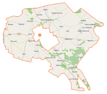
Kowalki is a village in the Polish rural municipality of Rypin and is located south of the city of Rypin.
It is bordered by the villages of Balin, Debi, Dylewo, Głowińska, Sikora, Lasotami and Pręczkami, belonging to the Rogowo municipality. The total area of the municipality is 489.36 hectares , of which 410.44 hectares are agricultural land.
history
The town charter of Rypin first mentions the village and its owner Kowalki Marsyniusza (Marsinius de Kowalikowy) in 1345.
Kowalki (Kowalky) was fragmented into several families of the nobility in the seventeenth century. As in the previous century, most of the village belonged to the Kowalkowski Herb Przeginia family. Mateusz Kowalkowski h. Przeginia, clerk in Bobrownicke and the hussar captain Kowalkowski h. Przeignia, dies in Cecora (1620). The village was devastated during the Swedish wars. Between 1942 and 1945 the place was called Schmiedehof .
Web links
Individual evidence
- ^ Bronisław (1846-1918) Red Chlebowski, Władysław (1818-1890) Red Walewski, Filip (1843-1885) Red Sulimierski: Słownik geograficzny Królestwa Polskiego i innych krajów słowiańskich. T. 4, [Kęs - Kutno] . Pressure "Wieku", January 1, 1883 ( malopolska.pl [accessed May 16, 2016]).

