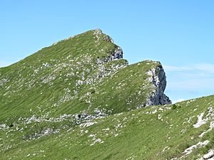
Crow (Ammergau Alps)
| crow | ||
|---|---|---|
|
Summit construction |
||
| height | 2010 m above sea level NN | |
| location | Bavaria , Germany | |
| Mountains | Ammergau Alps | |
| Coordinates | 47 ° 33 '9 " N , 10 ° 49' 26" E | |
|
|
||
| rock | Wetterstein lime | |
| Normal way | Hotel Ammerwald (approx. 1079 m) - Roggenbachtal - Fensterl - Krähe | |
The Krähe is a 2010 m high mountain in the Ammergau Alps in Bavaria . The summit can be reached as an easy but steep mountain hike from Ammerwald (approx. 1079 m) or from the Kenzenhütte . It can also be reached from Tegelberg via Niederstraußbergsattel and Maximiliansweg .
The crow is located in the Ammergebirge nature reserve (NSG-00274.01).
Crows cave
The entrance to the crows cave with three chambers (accessible with flashlights) is located near the Gabelschrofensattel .
Web links
Commons : Crow - Collection of Images
- kraxl.de - Entry about the mountain
- tourenwelt.info Entry about Crows Cave
Individual evidence
- ^ Official map - digital local map 1:10 000. In: BayernAtlas. State Office for Digitization, Broadband and Surveying Bavaria , accessed on January 12, 2016 .
- ↑ protectedplanet.net

