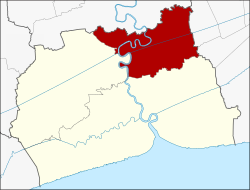
Amphoe Krathum Baen
|
Krathum Baen ่ เชียงราย |
|
|---|---|
| Province: | Samut Sakhon |
| Surface: | 135.276 km² |
| Residents: | 162,210 (2013) |
| Population density : | 1022 U / km² |
| ZIP : | 74110, 74130 |
| Geocode : | 7402 |
| map | |

|
|
Amphoe Krathum Baen ( Thai : ทุ่ ฝ ฝ เชียงราย ) is a district ( amphoe - administrative district) in the northern part of Samut Sakhon Province . The Samut Sakhon Province is located in the central region of Thailand .
geography
Samut Sakhon Province is located on the northern shore of the Gulf of Thailand
The main water resource is the Mae Nam Tha Chin (Tha Chin River) and the Khlong Phasi Charoen (Phasi Charoen Canal) .
Neighboring districts (from north clockwise): Amphoe Sam Phran of Nakhon Pathom Province , the Khet Nong Khaem and Bang Bon of Bangkok and the Amphoe Mueang Samut Sakhon and Ban Phaeo Samut Sakhon Province.
economy
- The Brother & Jan coffee roastery ( des บรา เด อ ร์ แอนด์ แจ น จำกัด ) is located in the Tambon Khlong Maduea of the district and produces the "Ia-Sae coffee" ( กาแฟ เอี๊ ยะ แซ ) , which has been awarded five OTOP stars in Thailand . The coffee is grown in selected plantations in both northern and southern Thailand . The Ia-Sae parent company is a small Chinese café near Thanon Yaowarat , which was founded in the early 19th century during the reign of King Prajadhipok (Rama VII) .
history
The area of today's Krathum Baen was originally part of the Mueang Samut Sakhon district . The Krathum Baen district was established in 1900. In 1926, the government added the tambon Tha Mai, Bang Yang, Nong Khai Kok and Om Noi from Amphoe Sam Phran the province of Nakhon Pathom added.
administration
Provincial Administration
The district of Krathum Baen is divided into ten tambon ("subdistricts" or "communities"), which are further subdivided into 76 muban ("villages").
| No. | Surname | Thai | Muban | Pop. |
|---|---|---|---|---|
| 1. | Talat Krathum Baen | ตลาด กระทุ่มแบน | - | 20,763 |
| 2. | Om Noi | อ้อม น้อย | - | 52,177 |
| 3. | Tha May | ท่า ไม้ | 12 | 9,978 |
| 4th | Suan Luang | สวนหลวง | 13 | 29,836 |
| 5. | Bang Yang | บาง ยาง | 13 | 5,099 |
| 6th | Khlong Maduea | คลอง มะเดื่อ | 11 | 19.901 |
| 7th | Nong Nok Khai | หนอง นก ไข่ | 8th | 3,634 |
| 8th. | Don Kai Di | ดอน ไก่ ดี | 6th | 7.165 |
| 9. | Khae Rai | แค ราย | 5 | 6,831 |
| 10. | Tha Sao | ท่า เสา | 8th | 6,826 |
Local administration
There is one commune with "big city" status ( Thesaban Nakhon ) in the county:
- Om Noi (Thai: เทศบาล นคร อ้อม น้อย ) consisting of the complete Tambon Om Noi.
There is one commune with "city" status ( Thesaban Mueang ) in the district:
- Krathum Baen (Thai: เทศบาล เมือง กระทุ่มแบน ) consisting of the complete Tambon Talat Krathum Baen.
There are two municipalities with "small town" status ( Thesaban Tambon ) in the district:
- Don Kai Di (Thai: เทศบาล ตำบล ดอน ไก่ ดี ) consisting of the complete tambon Don Kai Di.
- Suan Luang (Thai: เทศบาล ตำบล สวนหลวง ) consisting of the complete tambon Suan Luang.
In addition, there are six " tambon administration organizations " ( องค์การ บริหาร ส่วน ตำบล - Tambon Administrative Organizations, TAO)
- Tha Mai (Thai: องค์การ บริหาร ส่วน ตำบล ท่า ไม้ ) consisting of the complete Tambon Tha Mai.
- Bang Yang (Thai: องค์การ บริหาร ส่วน ตำบล บาง ยาง ) consisting of the complete Tambon Bang Yang.
- Khlong Maduea (Thai: องค์การ บริหารส่วน ตำบล คลอง มะเดื่อ ) consisting of the complete tambon Khlong Maduea.
- Nong Nok Khai (Thai: องค์การ บริหาร ส่วน ตำบล หนอง นก ไข่ ) consisting of the complete tambon Nong Nok Khai.
- Khae Rai (Thai: องค์การ บริหาร ส่วน ตำบล แค ราย ) consisting of the complete Tambon Khae Rai.
- Tha Sao (Thai: องค์การ บริหาร ส่วน ตำบล ท่า เสา ) consisting of the complete Tambon Tha Sao.
Individual evidence
- ^ Edward Van Roy: Sampheng - Bangkok's Chinatown Inside Out . Institute of Asian Studies, Chulalongkorn University, Bangkok 2007, ISBN 974-9990-33-1
- ↑ 2013 population statistics ( Thai ) Department of Provincial Administration. Retrieved August 10, 2014.
Web links
- One-Tambon-One-Product-Organization page about "Ia-Sae-Kaffee" (in Thai and English)
- More details on Amphoe Krathum Baen from amphoe.com (in Thai)
Coordinates: 13 ° 39 ' N , 100 ° 16' E