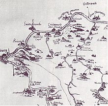
Krausenbach (Dammbach)
|
Krausenbach
Community Dammbach
Coordinates: 49 ° 51 ′ 39 ″ N , 9 ° 20 ′ 10 ″ E
|
|
|---|---|
| Height : | 236 m above sea level NHN |
| Incorporation : | June 1, 1976 |
Krausenbach is a district of the municipality of Dammbach in the Bavarian district of Aschaffenburg in Spessart .
geography
Krausenbach is located on State Road 2317 between Wintersbach and Rohrbrunn , at 236 m above sea level. NHN , where the Gößbach flows into the Dammbach .
The Krausenbach Forest was named after the place.
history
Krausenbach was first mentioned in 1241. The lost moated castle , the Unterschnorrhof stables from the 13th or 14th century, is located to the east at the entrance to the village, opposite the Unterschnorrhof and the Ferschenmühle in the Wiesengrund to the street. In 1676 the construction of the St. Wendelin Church began.
On July 1, 1862, the district office of Aschaffenburg was formed, on whose administrative area Krausenbach was located. In 1939, as everywhere in the German Reich, the designation district was introduced. Krausenbach was now one of the 33 communities in the old district of Aschaffenburg . On July 1, 1972, this merged with the Alzenau district in Lower Franconia to form the new Aschaffenburg district.
The previously independent municipalities of Krausenbach and Wintersbach merged on June 1, 1976 to form the new municipality of Dammbach.
Individual evidence
- ^ Federal Statistical Office (ed.): Historical municipality directory for the Federal Republic of Germany. Name, border and key number changes in municipalities, counties and administrative districts from May 27, 1970 to December 31, 1982 . W. Kohlhammer GmbH, Stuttgart / Mainz 1983, ISBN 3-17-003263-1 , p. 736 .

