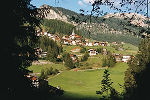
Kreuzspitze (Fanes Group)
| Kreuzspitze / Crusc de Rit | ||
|---|---|---|
|
Left the Kreuzspitze, right the Paresberg , in front the main town Wengen |
||
| height | 2021 m slm | |
| location | South Tyrol , Italy | |
| Mountains | Fanes group , Dolomites | |
| Coordinates | 46 ° 39 '55 " N , 11 ° 56' 43" E | |
|
|
||
The Kreuzspitze ( Ladin: Crusc de Rit ) is a 2021 meter high mountain near Wengen in South Tyrol . He belongs to the ridge of the Wengental in the southwest of Marebbe Valley separates the northeast. The municipal boundary runs deeper on the Enneberger side. The Kreuzspitze is a popular excursion destination from both places, which can be hiked or ridden by mountain bike.
The hiking trail from Wengen starts at the main town with the church. From there, above the cemetery, at a pumping station, a narrow path leads between new residential buildings to a small wood that is crossed. A forest road, which was only laid out in 2005, has to be crossed before reaching the Barbarakapelle via meadows. The path would continue from the chapel to Altwengen with its old church tower. This section of the path is an example of the old Ladin path culture.
It is shorter to take a small path away from the chapel up into the forest there and thus directly to Ciablun ( snack station). In the past, the hiking trail continued up the slope through the homestead, following the fall line . Today this is private, even if the old path markings can still be found on the slope. The path would come out again on the wooden road at a crossroads with a wooden gate.
Today's route continues along the road past a small chapel to Runch with an old, large Gothic former court house, a representative of a Ladin house type , on to Biei, Wengen's highest homestead, up a long path that leads past the aforementioned cross with wooden gate . The Holzstraße continues in a long S-curve before turning left again towards Ritjoch (Ju de Rit). Before this bend you can already see two parallel old furrows in the thin trees on the left, which can again serve as shortcuts if you do not want to walk the Holzstraße. Finally, a small ridge comes down the fall line from the right, which you follow up to Holzstraße. On the other side of the gravel road, a narrow forest path begins, which finally leads diagonally up towards the Kreuzspitze. At the top you come across a path coming from the left, from the Ritjoch. Follow the path further up on the wooded ridge until you come out at a meadow with a cross and a bench. A narrow path begins at the forest on the right and leads to the Kreuzspitze. A few years ago this path was still a root climbing route, now it is also accessible with mountain bikes.
From the Kreuzspitze (summit book) you have a beautiful view over the Wengental, the valley of Enneberg, also to the Kronplatz .
If you go west on the ridge, you either come back the same way, or you continue on the ridge to the Ritjoch with the biotope lake (Lè de Rit). Further to the west is the Cornspitze, which can also be hiked. To the east of the Kreuzspitze are the Ritwiesen, over which you can also hike back.


