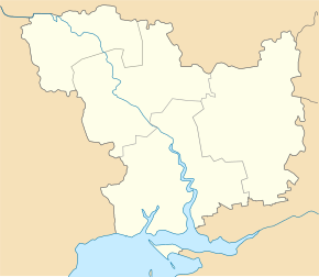
Krywe Osero Druhe
| Krywe Osero Druhe | ||
| Криве Озеро Друге | ||

|
|
|
| Basic data | ||
|---|---|---|
| Oblast : | Mykolaiv Oblast | |
| Rajon : | Krywe Osero district | |
| Height : | no information | |
| Area : | 8.478 km² | |
| Residents : | 2,766 (2001) | |
| Population density : | 326 inhabitants per km² | |
| Postcodes : | 55101 | |
| Area code : | +380 5133 | |
| Geographic location : | 47 ° 56 ' N , 30 ° 20' E | |
| KOATUU : | 4823981601 | |
| Administrative structure : | 1 village | |
| Address: | вул. Горького буд. 249 55 101 с. Криве Озеро Друге |
|
| Website : | City council website | |
| Statistical information | ||
|
|
||
Krywe Osero Druhe ( Ukrainian Криве Озеро Друге ; Russian Кривое Озеро Второе Krivoye Osero Wtoroje ) is a village in the northwest of the Ukrainian Oblast of Mykolaiv with about 2,700 inhabitants (2001).
Krywe Osero Druhe was the administrative center of the district council of the same name in the west of the district Krywe Osero , to which the village of Semeniwka ( Семенівка , formerly Червоний Орач Tscherwonyj Orach , ⊙ ) with about 250 inhabitants belonged. In the meantime it is part of the rural community of Krywe Osero .
The village is located on the bank of the Kodyma , a right tributary of the Southern Bug opposite the district center Krywe Osero and 200 km northwest of the Oblast center Mykolaiv .
The M 05 trunk road runs to the west of the village .
Individual evidence
- ↑ Local website on the official website of the Verkhovna Rada ; accessed on July 25, 2019 (Ukrainian)
- ^ Website of the district council on the official website of the Verkhovna Rada; accessed on July 25, 2019 (Ukrainian)
- ^ Territorial Community of Krywe Osero ; accessed on July 25, 2019 (Ukrainian)

