Krywe Osero
| Krywe Osero | ||
| Криве Озеро | ||

|
|
|
| Basic data | ||
|---|---|---|
| Oblast : | Mykolaiv Oblast | |
| Rajon : | Krywe Osero district | |
| Height : | no information | |
| Area : | 8.48 km² | |
| Residents : | 7,717 (2017) | |
| Population density : | 910 inhabitants per km² | |
| Postcodes : | 55100 | |
| Area code : | +380 5133 | |
| Geographic location : | 47 ° 57 ' N , 30 ° 21' E | |
| KOATUU : | 4823955100 | |
| Administrative structure : | 1 urban-type settlement | |
| Address: | вул. 1 Травня 15 55 100 смт Криве Озеро |
|
| Website : | City council website | |
| Statistical information | ||
|
|
||
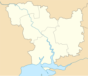
Krywe Osero ( Ukrainian Криве Озеро ; Russian Кривое Озеро Krivoye Osero ) is an urban-type settlement in the northwest of the Ukrainian Mykolaiv Oblast with about 7,700 inhabitants (2017).
Krywe Osero is the administrative seat of the Rajon of the same name and is located 210 km northwest of the Oblast center Mykolaiv on the Ukrainian highway M 05 and on the Kodyma , a right tributary of the Southern Bug . On the opposite bank of the river is the village of Krywe Osero Druhe with around 2700 inhabitants.
The village was founded in 1762 and has had urban-type settlement status since 1970.
Rajon
Krywe Osero is the administrative center of Krywe Osero Raion . The Rajon is located in the north-west of Mykolaiv Oblast, has about 25,000 inhabitants and an area of 814 km². The population density is 31 inhabitants per km².
Web links
- Local history of Krywe Osero in the history of the cities and villages of the Ukrainian SSR (Ukrainian)
Individual evidence
- ↑ Cities in Ukraine on pop-stat.mashke.org; accessed on January 6, 2018


