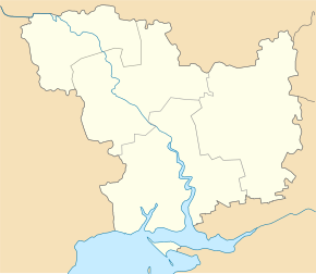
Beresnehuwate
| Beresnehuwate | ||
| Березнегувате | ||

|
|
|
| Basic data | ||
|---|---|---|
| Oblast : | Mykolaiv Oblast | |
| Rajon : | Bereznehuwate district | |
| Height : | 18 m | |
| Area : | 6.4817 km² | |
| Residents : | 7,778 (2014) | |
| Population density : | 1,200 inhabitants per km² | |
| Postcodes : | 56200 | |
| Area code : | +380 5168 | |
| Geographic location : | 47 ° 19 ' N , 32 ° 51' E | |
| KOATUU : | 4821155100 | |
| Administrative structure : | 1 urban-type settlement , 3 villages | |
| Address: | пл. Леніна 10 56200 смт. Березнегувате |
|
| Website : | http://berezneguvate.com.ua/ | |
| Statistical information | ||
|
|
||
Beresnehuwate ( Ukrainian Березнегувате ; Russian Березнеговатое Beresnegowatoje ) is an urban-type in the Ukrainian oblast Mykolajiw with about 7,700 inhabitants (2014). Beresnehuwate is the administrative center of the Rajon of the same name .
geography
Beresnehuwate is located in the east of the Oblast 96 km northeast of the Oblast center Mykolaiv on the river Vysun , a 195 km long right tributary of the Inhulez . The nearest train station is 13 km from the village.
Besides Beresnehuwate, the villages belong to the settlement council
- Kalacheve ( Калачеве ) with about 90 inhabitants
- Malomychailiwske ( Маломихайлівське ) with about 50 inhabitants
- Chervonopillja ( Червонопілля ) with about 210 inhabitants.
history
The village was founded by Cossacks in the 1780s . The village was occupied by Wehrmacht troops on August 18, 1941 , and liberated by Red Army troops on March 14, 1944 . Beresnehuwate has had urban-type settlement status since 1959. The former Jewish colony of Nahartawa ( Нагартава ) is now a district of Bereznehuwate.
Population development
| 1799 | 1917 | 1959 | 1970 | 1979 | 1989 | 2001 | 2014 |
|---|---|---|---|---|---|---|---|
| 487 | 4,800 | 7,095 | 6,992 | 7,472 | 8,278 | 7,796 | 7,778 |
Source: 1799-1917 1959-2014
sons and daughters of the town
- Sergei Ivanovich Syrowatski (1925–1979), theoretical physicist
Rajon
Beresnehuwate is the administrative seat of the Rajon of the same name. The Rajon Beresnehuwate km² 20,900 inhabitants and an area of the 1,263th The population density is 17 people per km². In the east, the Rajon borders the Kherson Oblast .
Web links
- History of Cities and Villages of Ukraine Bereznehuwate (Russian)
- Administrative subdivision of the Oblast on the Mykolaiv Oblast side
Individual evidence
- ↑ a b Demography of Ukrainian cities on pop-stat.mashke.org, accessed on May 16, 2014
- ↑ a b History of Cities and Villages of Ukraine -Beresnehuwate- on ukrssr.ru ( Memento of the original from May 3, 2015 in the Internet Archive ) Info: The archive link has been inserted automatically and has not yet been checked. Please check the original and archive link according to the instructions and then remove this notice. (Russian)
- ↑ Jewish agricultural colonies in the south of Ukraine and Crimea ( Memento of the original dated February 6, 2011 in the Internet Archive ) Info: The archive link has been inserted automatically and has not yet been checked. Please check the original and archive link according to the instructions and then remove this notice. (Russian)


