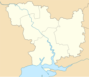
Oleksandrivka (Voznesensk)
| Oleksandrivka | ||
| Олександрівка | ||

|
|
|
| Basic data | ||
|---|---|---|
| Oblast : | Mykolaiv Oblast | |
| Rajon : | Voznesensk Raion | |
| Height : | no information | |
| Area : | 0.5 km² | |
| Residents : | 5,368 (2014) | |
| Population density : | 10,736 inhabitants per km² | |
| Postcodes : | 56532 | |
| Area code : | +380 5134 | |
| Geographic location : | 47 ° 42 ′ N , 31 ° 16 ′ E | |
| KOATUU : | 4822055200 | |
| Administrative structure : | 1 urban-type settlement , 2 villages | |
| Address: | вул. ген Подзігуна 208 56530 смт. Олександрівка |
|
| Statistical information | ||
|
|
||
Oleksandrivka ( Ukrainian Олександрівка ; Russian Александровка Alexandrowka ) is an urban-type settlement in the Ukrainian Oblast of Mykolaiv with about 5300 inhabitants (2014).
Oleksandrivka is located in Voznesensk Raion on the bank of the South Bend, 105 km northwest of the Mykolaiv Oblast center and 17 km north of the Voznesensk Raion on the regional roads P-06 and P-75 .
The village, founded in 1774, received urban-type settlement status in 1968. The settlement council municipality includes, in addition to Oleksandriwka, the villages Trykratne ( Трикратне ) and Wesselyj Rosdil ( Веселий Розділ ).
Individual evidence
- ↑ Cities in Ukraine at pop-stat.mashke.org, accessed December 5, 2014

