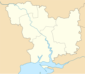
Bratske
| Bratske | ||
| Братське | ||

|
|
|
| Basic data | ||
|---|---|---|
| Oblast : | Mykolaiv Oblast | |
| Rajon : | Bratske district | |
| Height : | no information | |
| Area : | 2.91 km² | |
| Residents : | 5,313 (2016) | |
| Population density : | 1,826 inhabitants per km² | |
| Postcodes : | 55400 | |
| Area code : | +380 5131 | |
| Geographic location : | 47 ° 52 ' N , 31 ° 34' E | |
| KOATUU : | 4821455100 | |
| Administrative structure : | 1 urban-type settlement , 6 villages | |
| Address: | вул. Леніна 104 55400 смт Братське |
|
| Website : | http://bratske.mk.gov.ua/ | |
| Statistical information | ||
|
|
||
Bratske ( Ukrainian Братське ; Russian Братское Bratskoje ) is an urban-type settlement in the north of the Ukrainian Oblast of Mykolaiv with about 5300 inhabitants (2016). Bratske is the administrative center of the raion of the same name .
geography
Bratske located 121 km north of Oblastzentrum Mykolaiv , 113 km southwest of Kropywnyzkyj the river Mertwowid (Ukrainian Мертвовід ), a 124 km long left tributary of the Southern Bug . The nearest train station is 24 km away in Lyudmylivka (Ukrainian Людмилівка ) and the nearest towns are Voznesensk 44 km south and Yuzhnoukrajinsk the same distance west of the town.
In addition to Bratske, the settlement council also includes the villages:
- Antonowe (Ukrainian Антонове ) with about 430 inhabitants
- Wyssoka Hora (Ukrainian Висока Гора ) with about 200 inhabitants
- Zelenyj Yar (Ukrainian Зелений Яр ) with about 100 inhabitants
- Kamjanuwatka (Ukrainian Кам'януватка ) with about 380 inhabitants
- Novoolexijiwka (Ukrainian Новоолексіївка ) with about 20 inhabitants
- Oseryniwka (Ukrainian Озеринівка ) with about 130 inhabitants.
history
Founded as a Cossack village between 1760 and 1770, the first written mention comes from the year 1788. The village was occupied by troops of the Wehrmacht on August 7, 1941 and liberated on March 19, 1944 by Red Army troops. Bratske has been a district center since 1923 and has had the status of an urban-type settlement since 1956.
Population development
| 1883 | 1916 | 1959 | 1970 | 1979 | 1989 | 2001 | 2016 | 2018 |
|---|---|---|---|---|---|---|---|---|
| 1,159 | 2,360 | 5,823 | 5,493 | 6,741 | 6,925 | 6.178 | 5,313 | 5,225 |
Source: 1883–1916, from 1959
Rajon
Bratske is the administrative seat of the Rajons of the same name, founded in 1923. The Bratske Rajon has 18,450 inhabitants and an area of 1129 km². The population density is 16 people per km². In the north and east, the Rajon borders on the Kirovohrad Oblast .
Web links
- Entry on the place in the Encyclopedia of Modern Ukraine (Ukrainian)
Individual evidence
- ↑ a b Demography of Ukrainian cities on pop-stat.mashke.org
- ↑ a b Local history Bratske in the history of the cities and villages of the Ukrainian SSR ; accessed on March 14, 2019 (Ukrainian)


