Bashtanka
| Bashtanka | ||
| Баштанка | ||

|
|
|
| Basic data | ||
|---|---|---|
| Oblast : | Mykolaiv Oblast | |
| Rajon : | Bashtanka district | |
| Height : | 78 m | |
| Area : | 7.14 km² | |
| Residents : | 12,631 (2015) | |
| Population density : | 1,769 inhabitants per km² | |
| Postcodes : | 56100 | |
| Area code : | +380 5158 | |
| Geographic location : | 47 ° 24 ' N , 32 ° 26' E | |
| KOATUU : | 4820610100 | |
| Administrative structure : | 1 city , 4 villages, 1 settlement | |
| Mayor : | Volodymyr Rybachenko | |
| Address: | вул. Баштанської республіки 38 56 100 м. Баштанка |
|
| Statistical information | ||
|
|
||
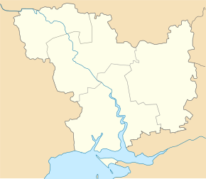
Bashtanka (Ukrainian and Russian Баштанка ) is a city in the east of Mykolaiv Oblast in Ukraine with about 12,500 inhabitants (2015).
The city is located east of the Inhul around an artificial reservoir ("sun reservoir") about 32 kilometers north of the Oblast capital Mykolaiv . The Znamyanka – Mykolaiv railway runs east of the village.
Bashtanka is the administrative seat of Bashtanka Raion . The urban district of Bashtanka is divided into the three villages Shevchenko (Шевченко), Zelenyj Yar (Зелений Яр), Trudowe (Трудове) and the settlement Andriivka (Андріївка) in addition to the actual city .
The place was founded in 1806 and was called Poltawka (Полтавка) until 1928 . At the beginning of the Russian Civil War , the Bashtanka Republic was proclaimed here. In 1952 the Inhulez irrigation system was put into operation, creating a network of reservoirs in the middle of the village.
population
| 1989 | 2001 | 2005 | 2015 |
|---|---|---|---|
| 12,873 | 13,146 | 12,814 | 12,631 |
Source:
Web links
Individual evidence
- ↑ a b Demography of Ukrainian cities on pop-stat.mashke.org

