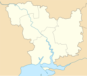
Snihuriwka
| Snihuriwka | ||
| Снігурівка | ||

|
|
|
| Basic data | ||
|---|---|---|
| Oblast : | Mykolaiv Oblast | |
| Rajon : | Snihurivka district | |
| Height : | 49 m | |
| Area : | 7.58 km² | |
| Residents : | 12,505 (2019) | |
| Population density : | 1,650 inhabitants per km² | |
| Postcodes : | 57300 | |
| Area code : | +380 5162 | |
| Geographic location : | 47 ° 5 ' N , 32 ° 48' E | |
| KOATUU : | 4825710100 | |
| Administrative structure : | 1 city | |
| Address: | вул. Жовтнева 124 57300 м. Снігурівка |
|
| Website : | http://snigiryevka-rada.gov.ua/ | |
| Statistical information | ||
|
|
||
Snihuriwka ( Ukrainian Снігурівка ; Russian Снигирёвка Snigirjowka ) is a city in eastern Mykolaiv Oblast in Ukraine . It is located about 62 kilometers east of the oblast capital Mykolaiv on the right bank of the Inhulez and has 12,500 inhabitants (2019).
The village was founded in 1812 by settlers from the Mogilev governorate , the name was chosen after one of the settlers' places of origin. During the Second World War in March 1944 in the area of the place in the course of the Bereznegowatoje-Snigirjower operation there was a heavy battle .
Snihuriwka is the administrative center of the raion of the same name and the community center of the territorial community Snihuriwka, which also includes the following localities:
- Afanassijiwka ( Афанасіївка )
- Jurivka ( Юр'ївка )
- Wassyliwka ( Василівка )
- Yevhenivka ( Євгенівка )
- Pavlo-Marjaniwka ( Павло-Мар'янівка )
- Kalyniwka ( Калинівка )
- Burchanivka ( Бурханівка )
- Lyubymivka ( Любимівка )
- Kobsarzi ( Кобзарці )
- Novopawliwske ( Новопавлівське )
- Novovassyliwka ( Нововасилівка )
- Halahanivka ( Галаганівка )
- Jelyzavetivka ( Єлизаветівка )
- Novokondakowe ( Новокондакове )
- Jasna Polyana ( Ясна Поляна )
- Pavlivka ( Павлівка )
- Ivano-Kepyne ( Івано-Кепине )
- Perschotrawnewe ( Першотравневе )
- Trudolyubivka ( Трудолюбівка )
- Wassylky ( Васильки )
- Tamaryne ( Тамарине )
- Besimenne ( Безіменне )
sons and daughters of the town
- Serhij Chlan (* 1972), politician
- Jurij Dmitrulin (* 1975), football player
Individual evidence
- ↑ Demography of Ukrainian cities on pop-stat.mashke.org ; accessed on October 29, 2019
- ^ Snihuriwka Community ; accessed on October 29, 2019 (Ukrainian)
- ↑ Хлань Сергій Володимирович , ednist.info (Ukrainian)
- ↑ Хлань Сергій Володимирович , agropolit.com (Ukrainian)

