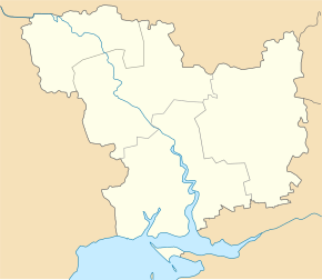
Kazanka (Mykolaiv)
| Kasanka | ||
| Казанка | ||

|
|
|
| Basic data | ||
|---|---|---|
| Oblast : | Mykolaiv Oblast | |
| Rajon : | Kazanka District | |
| Height : | 89 m | |
| Area : | 13.00 km² | |
| Residents : | 7,179 (2016) | |
| Population density : | 552 inhabitants per km² | |
| Postcodes : | 56000 | |
| Area code : | +380 5164 | |
| Geographic location : | 47 ° 49 ' N , 32 ° 50' E | |
| KOATUU : | 4823655100 | |
| Administrative structure : | 1 urban-type settlement , 1 village | |
| Mayor : | Natalija Palanitsch | |
| Address: | вул. Миру 228 56000 смт Казанка |
|
| Website : | http://www.kazanka.ho.ua/ | |
| Statistical information | ||
|
|
||
Kazanka (Ukrainian and Russian Казанка ) is an urban-type settlement in the center of Ukraine on both banks of the Vysun River with 7,179 inhabitants (2016).
The place was founded in 1800 by farmers from the Kursk Governorate , the name was chosen in honor of Our Lady of Kazan . The place was in the Cherson Governorate when it was founded and later became part of today 's Mykolaiv Oblast .
geography
The place is the administrative center of the Kazanka Rajon in the northeast of the Mykolaiv Oblast and is located about 132 km northeast of the Oblast capital Mykolaiv and almost 50 km west of Krywyj Rih . Administratively, in addition to the settlement, the village Lasariwka (Лазарівка), located north of the settlement, belongs to the settlement council.
Rajon
Kasanka Raion, administered from Kazanka , was founded in 1923. It borders in the north and northwest on the Kirovohrad Oblast, in the east on the Dnepropetrovsk Oblast and in the southeast on the Zaporizhia Oblast .
The Rajon has an area of 1349 km² and a population of 24,745 inhabitants. The population density in the Rajon is 18 inhabitants per km².
Web links
- Information on the history of the place (Russian)
- Entry on the place in the Encyclopedia of Modern Ukraine (Ukrainian)
Individual evidence
- ↑ Population figures on pop-stat.mashke.org


