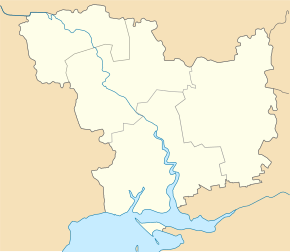
Kostjantyniwka (Arbusynka)
| Kostyantynivka | ||
| Костянтинівка | ||

|
|
|
| Basic data | ||
|---|---|---|
| Oblast : | Mykolaiv Oblast | |
| Rajon : | Arbusynka district | |
| Height : | no information | |
| Area : | 6.07 km² | |
| Residents : | 2,212 (2014) | |
| Population density : | 364 inhabitants per km² | |
| Postcodes : | 55343 | |
| Area code : | +380 5132 | |
| Geographic location : | 47 ° 50 ' N , 31 ° 8' E | |
| KOATUU : | 4820355700 | |
| Administrative structure : | 1 urban-type settlement , 1 village | |
| Address: | площа Жовтневої революції 20 55300 смт. Костянтинівка |
|
| Statistical information | ||
|
|
||
Kostjantyniwka ( Ukrainian Костянтинівка ; Russian Константиновка Konstantinowka ) is an urban-type settlement in the Ukrainian Oblast of Mykolaiv with about 2,200 inhabitants (2014).
Kostyantynivka borders the city of Yuzhnoukrajinsk and is located on the left bank of the southern bow in Arbusynka district opposite the village Bohdaniwka , which is connected by a ferry , 127 km northwest of the Mykolaiv oblast center and 19 km southwest of the Arbusynka district center .
The village, founded in 1703, received urban-type settlement status in 1976. Kostjantyniwka is the center of the settlement council of the same name, which also includes the village of Buske ( Бузьке ) with about 260 inhabitants.
Individual evidence
- ↑ Cities in Ukraine at pop-stat.mashke.org, last accessed on December 19, 2014

