Kuželovský potok
| Kuželovský potok | ||
|
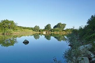
Pond in the headwaters south of Kuželov |
||
| Data | ||
| location | Czech Republic | |
| River system | Danube | |
| Drain over | Velička → March → Danube → Black Sea | |
| source | at the Kuželov windmill in the White Carpathians 48 ° 51 ′ 17 ″ N , 17 ° 29 ′ 31 ″ E |
|
| Source height | 345 m nm | |
| muzzle | south of Hroznová Lhota in the Velička coordinates: 48 ° 53 ′ 42 ″ N , 17 ° 24 ′ 58 ″ E 48 ° 53 ′ 42 ″ N , 17 ° 24 ′ 58 ″ E |
|
| Mouth height | 189 m nm | |
| Height difference | 156 m | |
| Bottom slope | 20 ‰ | |
| length | 7.9 km | |
| Catchment area | 28.9 km² | |
| Drain |
MQ |
100 l / s |
The Kuželovský potok is a left tributary of the Velička in the Czech Republic .
geography
The Kuželovský potok rises on the western slope of the Bojiště ( 438 m ) below the Kuželov windmill in the White Carpathians . The towns of Kuželov and Hrubá Vrbka lie on its course in a north-westerly direction . South of Hroznová Lhota , the brook flows into the Velička in Dolnomoravský úval ( Southern March Basin ).
The Kuželovský potok has a length of 7.9 km, its catchment area is 28.9 km².
Tributaries
- Malanský potok (l), below Hrubá Vrbka
- Bařinský potok (r), below Hrubá Vrbka
Individual evidence
- ↑ Page no longer available , search in web archives:
