Cuba (run)
| Cuba | ||
|---|---|---|
|
|
||
| Coordinates | 9 ° 23 ′ S , 124 ° 16 ′ E | |
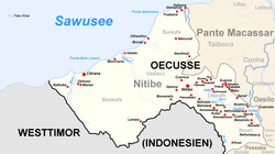
 Cuba is located in the center of the sucos Lelaufe in Nitibe Cuba is located in the center of the sucos Lelaufe in Nitibe
|
||
| Basic data | ||
| Country | East Timor | |
| Oe-Cusse Ambeno | ||
| Administrative office | Nitibe | |
| ISO 3166-2 | TL-OE | |
| Suco | Run | |
| height | 512 m | |
Cuba is an East Timorese street village in the center of Sucos Lelaufe ( Nitibe administrative office , Oe-Cusse Ambeno special administrative region ). The place is at an altitude of 512 m . The Sucos primary school is located west of Cuba. Further west is on the road the settlement Numatambing , southeast of the village Netembintemo .
Individual evidence
- ↑ UNMIT map from August 2008 ( Memento from December 3, 2011 in the Internet Archive ) (PDF file; 392 kB)
