Kunisaki Peninsula
| Kunisaki Peninsula | ||
 |
||
| Geographical location | ||
|
|
||
| Coordinates | 33 ° 32 ' N , 131 ° 35' E | |
| Waters 1 | Seto Inland Sea | |
| length | 35 km | |
| width | 30 km | |
 Elevation map |
||
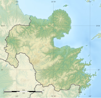
The Kunisaki Peninsula ( Japanese 国 東 半島 , Kunisaki-hantō ) is a peninsula in Ōita Prefecture in Japan .
It is located northeast of Ōita . The marine region of Suō-nada extends to the north, Iyo-nada to the east and Beppu Bay to the south , both of which belong to the Seto Inland Sea . The communities on the peninsula include Bungo-Takada , Kitsuki , Kunisaki, and Hiji . The island of Himeshima is five kilometers off the coast .
The peninsula was formed by volcanoes . The largest of these is the 732 m high Futago-san ( 両 子 山 ).
