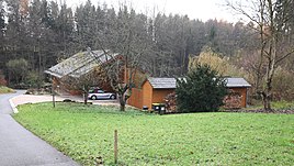
Lämmermühle (Coburg)
|
Lamb mill
independent city of Coburg
Coordinates: 50 ° 15 ′ 19 ″ N , 10 ° 55 ′ 7 ″ E
|
|
|---|---|
| Height : | 335 m above sea level NHN |
| Residents : | 5 (1970) |
| Postal code : | 96450 |
| Area code : | 09561 |
Lämmermühle is part of the municipality of the Upper Franconian city of Coburg , which was united with the Scheuerfeld district in 1868 .
geography
The place is about 3.5 kilometers west of Coburg near Scheuerfeld at the southern end of the Rohrbach.
history
After Eichhof's lord of the palace, Friedrich Christian von Merklin, acquired the Lämmereller, plots of land with poor grass growth, from the princely chamber in 1733, he had a mill built there by master miller Johann Luther . A drip house was also built in the vicinity of the mill . The mill was also called the Upper Mill. The name Lämmermühle is documented for the first time in 1751. In addition to the Rohrbach, water from the Wohlbach was used to run the mill with the help of a mill ditch.
Lämmermühle was on the Scheuerfeld corridor, but belonged to the Eichhof community. 1868 Eichhof was with its local lambs mill and bone mill combined during the first local government reform in the Coburg region with the community Scheuerfeld. At that time, the Lämmermühle consisted of a 10,481 hectare property, built on with a one-story and two two-story houses as well as a grinding mill and stables. The mill stood still from the end of the 19th century and in 1903 the mill wheel was removed. The property remained the property of the Luther family until 1919. In order to obtain water rights, the owner had a mill wheel installed again to drive a forage cutting machine in 1925. After the connection to the power grid in 1934/1935, the mill operations ended.
In 1925 Lämmermühle had 16 people and two residential buildings. The responsible Protestant church and school were in Scheuerfeld, 1.2 kilometers away. In 1950 the wasteland had eight residents and one residential building, six in 1961 and five in 1970.
In the course of the regional reform , Scheuerfeld and its district Lämmermühle were incorporated into the city of Coburg on July 1, 1972.
Web links
- Lämmermühle in the local database of the Bavarian State Library Online . Bavarian State Library
- Map from the 1860s in the Bavaria Atlas
Individual evidence
- ↑ a b Bavarian State Statistical Office (Hrsg.): Official local directory for Bavaria . Issue 335 of the articles on Bavaria's statistics. Munich 1973, DNB 740801384 , p. 145 ( digitized version ).
- ^ A b c Günther Bätz, Roland Eibl, Günther Leib, Rolf Lipfert: Scheuerfeld through the ages: 1100-2000, Chronik Frankenschwelle KG, 2000, ISBN 3-86180-014-4 . P. 252 f.
- ↑ Bavarian State Statistical Office (ed.): Localities directory for the Free State of Bavaria according to the census of June 16, 1925 and the territorial status of January 1, 1928 . Issue 109 of the articles on Bavaria's statistics. Munich 1928, Section II, Sp. 1048 ( digitized version ).
- ↑ Bavarian State Statistical Office (ed.): Official place directory for Bavaria - edited on the basis of the census of September 13, 1950 . Issue 169 of the articles on Bavaria's statistics. Munich 1952, DNB 453660975 , Section II, Sp. 904 ( digitized version ).
- ↑ Bavarian State Statistical Office (ed.): Official city directory for Bavaria, territorial status on October 1, 1964 with statistical information from the 1961 census . Issue 260 of the articles on Bavaria's statistics. Munich 1964, DNB 453660959 , Section II, Sp. 665 ( digitized version ).
