Lütispitz
| Lütispitz | ||
|---|---|---|
|
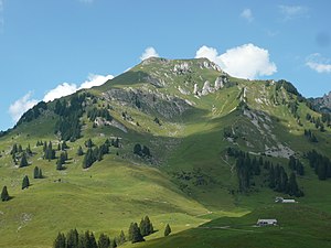
The Lütispitz from the south |
||
| height | 1987 m above sea level M. | |
| location | Canton of St. Gallen , Switzerland | |
| Mountains | Alpstein | |
| Dominance | 1.01 km → Schofwisspitz | |
| Notch height | 97 m ↓ unnamed notch | |
| Coordinates | 739 705 / 231861 | |
|
|
||
The Lütispitz is a mountain in western Alpstein in Switzerland . A ridge running from west to east forms the summit at its eastern end at an altitude of 1987 m. The border between the communities Wildhaus-Alt St. Johann (south) and Nesslau (north) runs over the summit ridge . There is a cross with a summit book on the summit. The Lütispitz is completely overgrown with grass. The Gräppelensee lies south below the Lütispitz .
The easiest access is from the west via the Windenpass, which connects the Luteren valley with that of the Thur . This way is technically easy.
Web links
Commons : Lütispitz - collection of images, videos and audio files
- Interactive 360-degree panorama from Lütispitz


