Lėvuo
| Lėvuo | ||
|
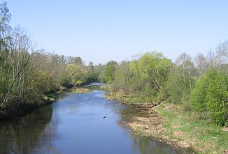
Lėvuo near Akmeniai |
||
| Data | ||
| location | Lithuania | |
| River system | Magnifying glass | |
| Drain over | Mūša → Lielupe → Riga Bay | |
| source | southeast of Skapiškis Lithuania 55 ° 52 ′ 49 ″ N , 25 ° 13 ′ 18 ″ E |
|
| Source height | approx. 86 m | |
| muzzle | north of Pasvalys in the Mūša coordinates: 56 ° 5 ′ 2 " N , 24 ° 25 ′ 37" E 56 ° 5 ′ 2 " N , 24 ° 25 ′ 37" E |
|
| Mouth height | approx. 23 m | |
| Height difference | approx. 63 m | |
| Bottom slope | approx. 0.43 ‰ | |
| length | 148 km | |
| Left tributaries | Kupa | |
| Right tributaries | Įstras | |
| Small towns | Pasvalys | |
| Communities | Kupiškis , Piniava | |
The Lėvuo is a river in northeastern Lithuania . With a length of almost 150 km, the catchment area is rather small at 1500 km². Accordingly, the river almost dries up and overgrows in summer, while the shallow banks are flooded when it rains. In this case, part of the water is drained into the Nevėžis via the Sanžilė Canal .
