La Paz (Tarlac)
| Municipality of La Paz | ||
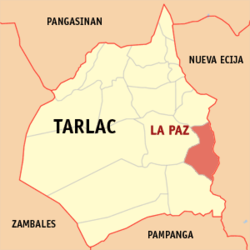
| Location of La Paz in the province of Tarlac | ||
|---|---|---|

|
||
| Basic data | ||
| Region : | Central Luzon | |
| Province : | Tarlac | |
| Barangays : | 21st | |
| District: | 3. District of Tarlac | |
| PSGC : | 036907000 | |
| Income class : | 2nd income bracket | |
| Households : | 10,361 May 1, 2000 census
|
|
| Population : | 64.017 August 1, 2015 census
|
|
| Population density : | 559.9 inhabitants per km² | |
| Area : | 114.33 km² | |
| Coordinates : | 15 ° 44 ′ N , 120 ° 38 ′ E | |
| Postal code : | 2314 | |
| Geographical location in the Philippines | ||
|
|
||
La Paz is a metropolitan parish in the Province of Tarlac on the island of Luzon in the Philippines . It has 64,017 inhabitants (August 1, 2015 census) who live in 21 barangays . She belongs to the 2nd income bracket of the communities in the Philippines.
The municipality of La Paz is located in the eastern part of the Tarlac Province and borders the Nueva Ecija Province . It borders the municipality of Victoria to the north, Concepcion to the south, and Tarlac City to the west . It is located approx. 20 km east of Tarlac City and approx. 144 km north of the Philippine capital Manila and can be reached from there via the Mc Arthur Highway.
Barangays
|
|
