La Piedad de Cabadas
| La Piedad de Cabadas | ||
|---|---|---|
|
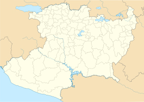
Coordinates: 20 ° 20 ′ N , 102 ° 1 ′ W La Piedad de Cabadas on the map of Michoacan
|
||
| Basic data | ||
| Country | Mexico | |
| State | Michoacan | |
| Municipio | La Piedad | |
| Residents | 83,323 (2010) | |
| Detailed data | ||
| Website | ||
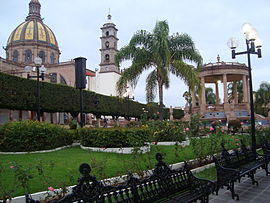
| In the center of La Piedad | ||
La Piedad de Cabadas , often short La Piedad , is the seventh largest city in the Mexican state of Michoacán with 83,323 inhabitants (2010 census) . The city is the administrative seat of the Municipio La Piedad .
The city was founded by the Aztecs and conquered by the Spanish invaders in 1530, who initially gave it the name San Sebastián Aramutarillo . When the settlement was given city status in 1871, it was given its current name: La Piedad de Cabadas . "La Piedad" means "Piety" and the addition was given in honor of the priest José Cabadas Corzo. The Cabadas Bridge, which was built between 1832–33 and connects the states of Michoacán and Guanajuato across the Lerma River, is also dedicated to this priest. La Piedad is located about 500 km west-northwest of Mexico City and about 190 km northwest of Morelia , the capital of the state of Michoacán.
La Piedad is a hub for agricultural products in the area, for example for maize and cattle breeding, and there are also textile industry operations here. One of the local specialties is pork knuckle with vinegar sauce.
The city's sporting figurehead is CF La Piedad , who has already spent two seasons in the Primera División , the highest Mexican soccer league.
sons and daughters of the town
- Mariano Silva y Aceves (1887–1937), lawyer, author and rector of the Universidad Nacional de México (UNM)
- Carlos Alvarado Lang (1905–1961), graphic artist
- Miguel Patiño Velázquez (1938–2019), Roman Catholic religious, Bishop of Apatzingán
- Catarino Tafoya (1940–2012), football player
- Ramón Morales (born 1975), football player

