Lacs de Maclu
| Petit Maclu | ||
|---|---|---|

|
||
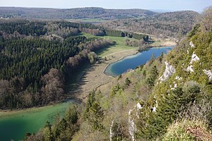
| Grand Maclu (left) and Peti Maclu (right) | ||
| Geographical location | Jura , France | |
| Data | ||
| Coordinates | 46 ° 37 '52 " N , 5 ° 54' 56" E | |
|
|
||
| Altitude above sea level | 779 m | |
| surface | 0.05 km² | |
| Maximum depth | 11 m | |
| Grand Maclu | ||
|---|---|---|

|
||
| the Lac du Grand Maclu | ||
| Geographical location | Jura , France | |
| Data | ||
| Coordinates | 46 ° 37 ′ 31 " N , 5 ° 54 ′ 27" E | |
|
|
||
| Altitude above sea level | 779 m | |
| surface | 0.21 km² | |
| Maximum depth | 24 m | |
As Lacs de Maclu are two adjacent lakes in the western section of the French Jura , in the department of Jura of the Franche-Comté referred. They are located at 779 m in a basin in the High Jura, in the region of the five lakes near Le Frasnois , around 12 km south of Champagnole .
The Grand Maclu has an area of 21 hectares , a length of around 1.1 km and a maximum width of around 300 m. Its greatest water depth is 24 m. The municipalities of Le Frasnois and La Chaux-du-Dombief share the water area .
The north-east adjoining Petit Maclu has an area of 5 hectares , a length of around 500 m and a maximum width of around 120 m. Its greatest water depth is 11 m. It lies entirely on the parish of Le Frasnois.
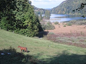
Both lakes are flanked in the southeast by the ridge of the Bois de Ban (up to 960 m ). On this limestone ridge , which drops very steeply towards the lakes, is the Belvédère des quatre Lacs , a lookout point with a view of the four lakes Grand Maclu, Petit Maclu, Lac de Narlay and Lac d'Ilay . The western bank of the Lacs de Maclu, on the other hand, is flat and has a swamp belt. The Grand Maclu is separated from the Lac d'Ilay by a hill. The lakes lie in a depression on the high plateau of Champagnole. During the high stages of the various ice ages , the basin was lined by the Jura glaciers with layers of marl and clay so that lakes could arise despite the karstified subsoil.
The Lacs de Maclu are fed by rainwater and small springs on the bank edge. The Petit Maclu normally drains through a 100 m long canal to the Grand Maclu. Since drinking water for the village of La Chaux-du-Dombief is derived from the Petit Maclu, the runoff regime can also be reversed. The Granx Maclu is drained by a stream to the west to Lac d'Ilay.
The landscape around the Lacs de Maclu is under nature protection. In the marshland around the lakes there are rare plant communities for the region, including the Schneidried (Cladium mariscus) .
Web links
- Details of the Lacs de Maclu. Archived from the original on July 11, 2011 ; accessed on May 8, 2017 . (French)
- Cinq Lacs nature reserve . Archived from the original on May 30, 2004 ; accessed on May 8, 2017 . (French)
