Lahnkopf
| Lahnkopf | ||
|---|---|---|
|
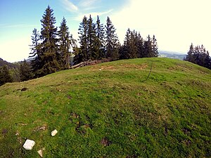
Summit area of the Lahnenkopf |
||
| height | 1416 m above sea level NHN | |
| location | Germany ( Bavaria ) | |
| Mountains | Bavarian Prealps | |
| Dominance | 0.8 km → Baumgartenschneid | |
| Notch height | 97 m | |
| Coordinates | 47 ° 41 ′ 57 " N , 11 ° 49 ′ 30" E | |
|
|
||
The Lahn head together with Baumgartenschneid , Riederstein and pipehead the southern end of the northern group of the Schliersee Mountains . The summit area, which is partly wooded and partly covered with meadow, can only be reached without a path and is rarely visited. The ascent is via the saddle to Baumgartenschneid or via steep alpine pastures over the upper Krainsberger Alm .

