Baumgartenschneid
| Baumgartenschneid | ||
|---|---|---|
|
Increase in winter |
||
| height | 1448 m | |
| location | Bavaria | |
| Mountains | Bavarian Prealps | |
| Dominance | 3.06 km → Rainerkopf | |
| Notch height | 327 m ↓ above the Kühzaglalm | |
| Coordinates | 47 ° 42 '9 " N , 11 ° 48' 33" E | |
|
|
||
The Baumgartenschneid is a 1448 m high mountain in the Bavarian Prealps east above the Tegernsee .
Location and climbing possibilities
The ascent to the summit is an easy mountain hike, with two hours for the 700 meters of ascent and 1.5 hours for the descent from Tegernsee .
The summit can also be reached in various ways from Rottach-Egern or Schliersee . On the ascent from Tegernsee or Rottach-Egern to the summit, you first pass the Galaun inn 1060 m and then the 1207 m high rock of Riederstein , on which the small Riederstein chapel stands.
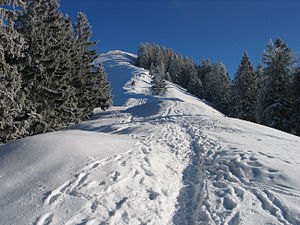
The summit is also a popular and easy-to-reach destination in winter. If the snow conditions are not too high, no snowshoes are required. Grödeln are recommended when there is ice.
The view from the summit cross of the Baumgartenschneid is mainly dominated by the Tegernsee. The surrounding Tegernsee mountains such as the Wallberg , the Setzberg, the Kampen and the Fockenstein can also be seen. In the east, the Wendelstein dominates the view. If visibility is good, the view goes north to Munich.
Web links
Individual evidence
- ↑ Evamaria Wecker / Luis Stitzinger: Mountain tours by bus & train, Bavarian Alps, Verlag Geobuch, Munich, 2002 ISBN 3-925308-09-1 , p. 147
- ↑ Bernd Riffler / Rudolf Steiger: Winter mountain tours without skis between Berchtesgaden and Allgäu, Verlag Bruckmann, Munich, 1987, ISBN 3-7654-2139-1 , p. 79


