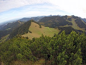
Rainer's head
| Rainer's head | ||
|---|---|---|
|
Rainerkopf from the water tip |
||
| height | 1463 m above sea level NHN | |
| location | Germany ( Bavaria ) | |
| Mountains | Bavarian Prealps | |
| Dominance | 0.6 km → Wasserspitz | |
| Notch height | 80 m | |
| Coordinates | 47 ° 41 '9 " N , 11 ° 50' 32" E | |
|
|
||
The Rainerkopf is a mountain peak on the border between the municipal areas of Schliersee and Rottach-Egern .
Together with water Spitz , Rinnerspitz and bottom cutting it forms a ridge of the watershed between Schliersee and Tegernsee represents.
The easiest way to get to the summit is via a simple path from the Raineralm .
Individual evidence
Web links
- Rainerkopf in the BayernAtlas

