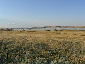
Lake DeSmet
| Lake DeSmet | |||||||||
|---|---|---|---|---|---|---|---|---|---|
| Lake DeSmet | |||||||||
|
|||||||||
|
|
|||||||||
| Coordinates | 44 ° 28 '35 " N , 106 ° 45' 5" W | ||||||||
| Data on the structure | |||||||||
| Data on the reservoir | |||||||||
| Altitude (at congestion destination ) | 1450 m | ||||||||
| Maximum depth | 37 m | ||||||||
| Storage space | 290 million m³ | ||||||||
Lake DeSmet is a reservoir in Johnson County in the US state of Wyoming . It is 1450 meters above sea level at the eastern foot of the Bighorn Mountains . It is named after Pierre-Jean De Smet , a Jesuit missionary from Belgium, who was probably the first Catholic priest to settle in the Bighorn area in 1840 and missionary among the local Indian peoples.
history
On December 21, 1866, warriors of the Lakota , Arapaho and Cheyenne destroyed a division of the US Army under Captain William Judd Fetterman not far from the lake in the Fetterman Battle .
Lake DeSmet was the largest natural lake in northern Wyoming until it was artificially expanded into a reservoir. He was fed by Shell Creek . In 1921 a dam was built for agricultural purposes in the north of the lake and water was supplied from Piney Creek. In the 1950s, the Reynolds Mining Corporation bought the reservoir and additional surrounding land, and expanded the reservoir with additional tributaries from Piney Creek and Clear Creek. Texaco purchased the reservoir in the early 1970s and expanded it to its present size by the late 1970s. Texaco sold the reservoir to the Lake DeSmet Counties Coalition in 2001 . The banks were largely left natural. Today the lake is accessible via an exit from US Highway 90 , north of Buffalo . The western bank is developed for tourism.
A supply tunnel 2535 m long and 2.6 m in diameter leads from Piney Creek to the lake. The storage capacity of the lake is 290 million m³. The maximum water depth is 37 m.
Individual evidence
- ↑ USGS
- ↑ Lake DeSmet in the Geographic Names Information System of the United States Geological Survey
- ↑ Wyoming Water Development Commission ( Memento of the original from October 4, 2006 in the Internet Archive ) Info: The archive link was automatically inserted and not yet checked. Please check the original and archive link according to the instructions and then remove this notice. (PDF; 4.5 MB)
- ^ A b c Johnson County, Wyoming: Lake DeSmet Operating Department

