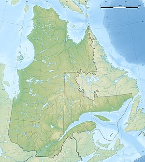
Mistassini Lake
| Lac Mistassini | ||
|---|---|---|
| Geographical location | Jamésie , North du Québec in Québec (Canada) | |
| Tributaries | Chalifour , Pépeshquasati , Takwa , Rivière Témiscamie / Lac Albanel , Wabissinane | |
| Drain | Rivière Rupert | |
| Islands | Île Tchapahipane , Île Rouleau | |
| Places on the shore | Mistissini | |
| Data | ||
| Coordinates | 50 ° 56 ′ N , 73 ° 38 ′ W | |
|
|
||
| Altitude above sea level | 372 m | |
| surface | 2 164 km² | |
| length | 161 km | |
| width | 19 km | |
| volume | 150 km³ | |
| Maximum depth | 180 m | |
| Middle deep | 69 m | |
| Catchment area | 18,100 km² | |

|
||
| Satellite image | ||
The Mistassinisee ( French Lac Mistassini ) is the largest natural body of water in the Canadian province of Québec with a water surface of 2164 km² .
The total area including islands is 2335 km². The freshwater lake is located in the southern part of Québec in a wooded and water-rich region that is completely uninhabited with the exception of the small town of Mistissini ( Baie-du-Poste ; around 3,500 inhabitants), which is located at the southern end of the lake.
The lake has a length of 161 km, is 19 km wide and is traversed lengthways by a chain of islands that almost divides it in half. In the center it has no clear border on the west side, on which many very small lakes directly adjoin the Mistassinisee. There it flows over the Rivière Rupert into James Bay .
The name of the lake is derived from the language of the indigenous people, the Cree , and means "big rock".
Canadian writer and director Boyce Richardson directed a 57-minute film about the Native American Cree Hunters of the Mistassini in 1974, produced by the National Film Board of Canada .
Tributaries
- Rivière Chalifour
- Rivière Pépeshquasati
- Rivière Takwa
- Outflow of Lac Albanel , which is fed by the Rivière Témiscamie
- Rivière Wabissinane
Islands
- Île Montpetit
- Île Manitounouc
- Île André-Michaux
- Île Marie-Victorin
- Île Dablon
- Ile Guillaume Couture
- Île Lemoine
- Ile de la Passe
- Île Tchapahipane - 30 km long island, the longest island in the chain of islands along the lake
- Île Pahipanouk
- Île Rouleau - located in the south of the lake, forms the central mountain of an impact crater
Peninsulas
- Presqu'île Abatagouche - in the south of the island chain
- Péninsule Ouachimiscau - in the north of the island chain, 22 km long
Web links
Individual evidence
- ↑ a b c Natural Resources Canada - The Atlas of Canada - Lakes ( Memento from January 14, 2013 in the Internet Archive )
- ↑ a b c d Commission de toponymie du Québec - Lac Mistassini
- ↑ R-ArcticNet - [RUPERT (RIVIERE DE) ET LE CHENAL CHIPASTOUC]
- ^ Natural Resources Canada
