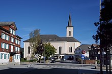
Achrainstrasse
The Achrainstraße ( L 49 , in the Dornbirn local area referred to in sections as Stiglingen and Wälderstraße ) is a state road in the Austrian state of Vorarlberg . It connects Vorarlberger Straße in the city of Dornbirn over the eponymous Achrain , a geographical altitude at the entrance to the Bregenzerwald , with the Bregenzerwaldstraße in Alberschwende over a length of around nine and a half kilometers .
Road layout
At the northern end of the Dornbirn district of Haselstauden , Achrainstraße branches off east of Vorarlberger Straße (L 190). The road here, together with the Haselstauderbach , along which it runs, forms the border of the densely built-up Dornbirn settlement area. To the north of it extends the Ried , a large green area between Dornbirn and the neighboring municipality of Lauterach . In this first section of the route, in which the Achrainstrasse runs parallel to the Haselstauderbach flowing directly next to it, the street is named Stiglingen in the local road network . The road then crosses under the Lindau – Bludenz railway line directly at the Haselstauden stop and shortly thereafter reaches the Haselstaud town center, where it meets and crosses Hofsteigstraße (L 3).
In the Dornbirn local road network, Achrainstraße from the junction in Haselstauden to the city and district limits is referred to as Wälderstraße (not to be confused with Wälderstraße L 16 between Lauterach and Wolfurt). From the junction with Hofsteigstraße it leads uphill and increasingly winding to the Haselstauder Berg or the area that is geographically referred to as Achrain . The name Achrain is probably composed of the words Ach , which refers to the Schwarzach running through the ravine , and Rain for an edge of the terrain. The Achrainstraße runs steadily upwards through the Dornbirn mountain area and crosses numerous mountain parcels belonging to the city of Dornbirn, such as Knie , Ruschen , Kreuzen , Adelsgehr and Winsau .
With the crossing of the Stauder Bach , the Achrainstraße finally reaches the parish of the Bregenzerwald community of Alberschwende at the Stauder parcel . In the slightly hilly terrain typical of the front Bregenzerwald, the Achrainstraße leads almost in a straight line through the Schwarzen plot belonging to Alberschwende to the center of Alberschwende. There the Achrainstraße meets the Bregenzerwaldstraße (L 200), which is the main traffic axis for individual traffic in the Bregenzerwald. In addition, at the same intersection where Achrainstraße meets Bregenzerwaldstraße, Bucher Straße (L 14) joins Bregenzerwaldstraße in the center of Alberschwende .
history
The construction of the street section, now known as Achrainstraße, from Haselstauder town center over the Achrain to Alberschwende began in 1884 and on September 30, 1885, the new street could be used for the first time with a cart. The road was completed in 1886 and was initially part of the Mittelwälder competitive road . From 1939 the street was part of the 1st order No. 10, with the introduction of the Federal Highway Act in 1948 it became part of the congruent federal highway 200, i.e. the Bregenzerwaldstraße .
The route has only been called Achrainstraße since the completion of the Achrain tunnel in January 2009, which enables Alberschwende to be reached directly from the Rheintal / Walgau motorway . Until then, the connection via today's Achrainstraße was the main route into the Vorderen Bregenzerwald from the Rhine Valley and part of the Bregenzerwaldstraße (L 200) (which was run as a federal highway until 2002 ). Today the Bregenzerwaldstraße runs from the roundabout with the L 190 in the Dornbirner Ried along the municipal boundary between Dornbirn and Schwarzach to the Achrain tunnel and through this on to the Schwarzachtobel with its confluence with the Alberschwender local area.
Originally, in the state road construction plan, the designation Landesstraße 49 was intended for a planned "village road" as a connection from Bregenz-Rieden via Wolfurt to Schwarzach. However, this connection was never realized, so that the number L 49 could finally be assigned in 2009 with the relocation of Bregenzerwaldstraße to the new route to Achrainstraße.
literature
- DI Herbert Gehrer: The expansion of Vorarlberg's streets for motorized traffic from the 1930s to 1983 . Office of the Vorarlberg State Government, Bregenz 1986.
Web links
- Ordinance of the state government on the declaration of the L 49 - Achrainstraße as a state road in the legal information system of the Republic of Austria
Individual evidence
- ^ Franz Kalb: Place names in Dornbirn . In: Stadtarchiv Dornbirn (Hrsg.): Dornbirner Schriften - Contributions to urban history . Volume 41. Dornbirn, 2012. ISBN 978-3-901900-33-4 . P. 9.
- ↑ Product chapel Winsau in Dornbirn Encyclopedia of the City Archives Dorbirn .
- ^ Gehrer: The expansion of the streets of Vorarlberg for motorized traffic from the 1930s to 1983 . 1986, p. 105.
- ^ Gehrer: The expansion of the streets of Vorarlberg for motorized traffic from the 1930s to 1983 . 1986, p. 187.


